
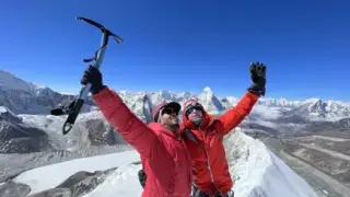
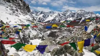

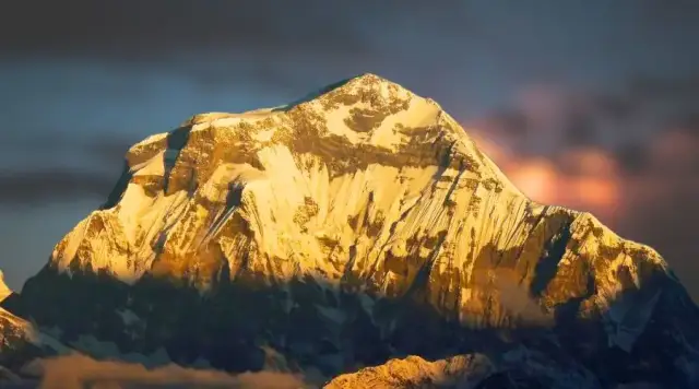

The South Face of Dhaulagiri (8,167 m) is a wall about 4,000 m high that nobody has climbed all the way to the summit. A Yugoslav team climbed the face in alpine style in 1981 but joined the Southeast Ridge at about 7,950 m and descended without going to the top. Tomaž Humar soloed a new line in 1999 and also finished on the Southeast Ridge, short of the summit. Only five expeditions had even aimed at the face by the end of 2023. Commercial expeditions, ours included, climb the Northeast Ridge.
- MountainDhaulagiri I, 8,167 m, 7th highest
- Face heightAbout 4,000 m
- Climbed to the summit?No, not as of 2026
- First attemptMessner's team, spring 1977 (about 6,150 m)
- Face first climbed1981, Yugoslav team, to the Southeast Ridge
- Best-known attemptTomaž Humar, solo, 1999
- Normal routeNortheast Ridge (first ascent 1960)
One of the world's most intimidating mountain faces is the South face of Dhaulagiri. Dhaulagiri, the seventh-highest mountain in the world which is located in Nepal, is notable for its challenging south face.
One of the most prominent mountains in the Himalayas is Dhaulagiri, which translates to "White Mountain" in Nepali and it rises 8,167 meters (26,795 ft) above sea level. The South Face rises about 4,000 m and is regarded as the hardest way up the mountain. Nobody has yet climbed it all the way to the summit.
The article below will explain the history, geography, and challenges of one of the great unclimbed walls on earth, and what a climber needs to know about Dhaulagiri today.
A bit of history
One of the tallest mountains in the world, Dhaulagiri is situated in western Nepal, just across the Kali Gandaki Gorge from the Annapurna massif, and is 8,167 meters above sea level. It is the crown of the Dhaulagiri Range, which stretches between the Kali Gandaki Gorge in the east and the Bheri River in the west. The Kali Gandaki Gorge is often called one of the world's deepest gorges.
A Swiss-led international expedition under Max Eiselin made the first successful ascent to the summit of Dhaulagiri on May 13, 1960. Kurt Diemberger, Peter Diener, Ernst Forrer, Albin Schelbert, Nyima Dorje Sherpa and Nawang Dorje Sherpa reached the top by the Northeast Ridge, which is still the normal route. The team was partly supplied by a small aircraft, the Yeti, which set a record for a high fixed-wing landing before it crashed and was abandoned.
The first serious attempt on the face came in spring 1977. Reinhold Messner, Peter Habeler, Otto Wiedemann and Michael Covington turned back at about 6,150 m, put off by active hanging glaciers above their line, and Messner later said he would not go back. In autumn 1981 a Yugoslav team of six Slovenian climbers made the first ascent of the face itself, in pure alpine style with no Sherpas above base camp and no bottled oxygen. Three of them climbed the face, joined the ridge high on the mountain and reached about 7,950 m on the Southeast Ridge before a storm drove them down the far side. The summit itself eluded them. From the start up the face on 15 October to reaching the village of Beni took 15 days.
Very few have tried since. ExplorersWeb counted 417 expeditions to Dhaulagiri I up to the end of 2023, and only five of them aimed at the South Face. A Polish team reached 7,550 m on the Southwest Ridge in 1986, and a Japanese soloist abandoned in 1987 before getting onto the face. The Slovenian alpinist Tomaž Humar made the best-known attempt in autumn 1999, alone and in alpine style. Over nine days he climbed a new line up the centre of the face, turned away from a rotten rock band at about 7,300 m, and finally came out on the Southeast Ridge at roughly 7,900 to 8,000 m (accounts differ). He then descended the normal route without going to the summit. Humar died in 2009 on Langtang Lirung. As of 2026 no one has climbed the South Face all the way to the top, and it remains one of the great unsolved problems of Himalayan mountaineering. Climbing the South Face has remained a challenging objective for many mountaineers because of its technical character.

Photo: Tomaž Humar (1969 to 2009)
Whatever their motivation may be, most climbers agree that scaling Dhaulagiri’s South face is a formidable challenge that requires skill and determination. Nobody has finished it yet, and only a handful of the world's best alpinists have even tried.
South Face Attempts, 1977 to 1999
These are the expeditions that set out to climb the South Face itself. None reached the summit by the face. A second party also tried in autumn 1977, with few details on record.
| Year | Team | Style | High point | Outcome | Source |
|---|---|---|---|---|---|
| Spring 1977 | Reinhold Messner, Peter Habeler, Otto Wiedemann, Michael Covington | Expedition, no bottled oxygen for Messner and Habeler | About 6,150 m | Turned back below hanging glaciers | AAJ 1978, ExplorersWeb |
| Autumn 1981 | Yugoslav (Slovenian) team: Stane Belak, Cene Berčič, Emil Tratnik on the face | Alpine style, no Sherpas above base camp, no oxygen | About 7,950 m, Southeast Ridge | First ascent of the face, summit not reached, descent by the Northeast Ridge | Alpine Journal 1983 |
| Autumn 1986 | Polish team led by Eugeniusz Chobrak | No Sherpas above base camp, no oxygen | 7,550 m (Maciej Berbeka, alone) | Joined the Southwest Ridge, turned back | ExplorersWeb, Himalayan Database |
| Autumn 1987 | Hiroshi Aota, Japan, solo | Solo | About 4,300 m | Abandoned before the face (avalanche danger) | ExplorersWeb |
| Autumn 1999 | Tomaž Humar, Slovenia, solo | Solo, alpine style, no oxygen | About 7,900 to 8,000 m, Southeast Ridge | New line on the face, summit not reached, descent by the Northeast Ridge | AAJ 2000, ExplorersWeb |
Dhaulagiri's Faces and Routes
| Route | First climbed | Status today |
|---|---|---|
| Northeast Ridge | 13 May 1960, Swiss-led expedition | Normal route, used by almost every expedition |
| Southeast Ridge | 1978, Japanese expedition | Rarely climbed, the ridge the 1981 and 1999 South Face climbs finished on |
| Southwest Ridge | 1978, Japanese expedition | Rarely climbed, joined by the 1986 Polish attempt |
| South Face, direct to summit | Never | Unclimbed as of 2026 |
The 1981 Yugoslav Climb, Day by Day
The dates and heights below follow Franci Savenc's report in the Alpine Journal (1983). The climbers reached the top of the face and the Southeast Ridge, not the summit.
On September 12, 1981, six alpinists accompanied by Mihan Khadka (liaison officer), five Nepalese staff, and 56 porters embarked upon the journey to the Dhaulagiri South face from Pokhara. They reached the Dhaulagiri Base camp on 23rd September which is located at an elevation of 3950m.
Because of bad weather and for acclimatization, climbers were only able to reach the elevation of 5300m until October 14. On October 15, Stane Belak, Cene Berčič and Emil Tratnik started up the face from their tent at 5,150 m. Falling stones pinned them down for 7 hours at about 5,500 m, and they reached 5,700 m by nightfall.
On October 17, they were able to reach an altitude of 6100m, moving along icefields and rocky terrain.

Photo: South Dhaulagiri Route
Rok Kolar and Joze Zupan started on October 18 and reached the tent at 5100m. However, they had to descend to meet Janez Sabolek, their sixth expedition companion.
On October 19, despite only 5-6 hours of climbing, they reached an altitude of 6900m.
On October 20 they reached the rock band at about 7,300 m, where ropes left by a 1978 Japanese expedition were still in place. The Alpine Journal report places this on the Southwest Ridge, while later accounts put the junction on the Southeast Ridge. With that, the face itself had been climbed.
On October 21, they could only scale 100 meters of height after a bad night.
Afterward, on 22nd October, they reached an elevation of 7550 m after a windy and cold night. They were only able to ascend roughly about 150 m on this day.
On 23 October they reached the right-hand edge of the huge snow slopes below the summit, at about 7,800 m.
On 24 October the leader radioed Base Camp with their plan for the descent. Then the mountain turned on them. The gas stove stopped functioning, icy winds buried the tents and the bone-chilling cold tested their spirits. They dumped everything they no longer needed and at noon reached the highest point of the Southeast Ridge, about 7,950 m by altimeter. Afterward, they took the north slope and descended to 7200m. Luckily, they found some usable abandoned tents, most probably left out by the Japanese. The communication with Base Camp had failed at this point in time.
On October 25, they climbed down via the North Rib. Dhaulagiri was still testing their endurance as bad weather was swiftly approaching via the west. In addition to a lack of food, 20cm thick snow made their life miserable during the night.
However, despite all the odds, they descended to an altitude of 6,000 m on 26th October and took shelter in a crevasse.
On October 27, after 60 cm of new snow, they ploughed through to 6,090 m on the ridge above the Dhaulagiri Glacier and the Thak Khola valley. They rapidly descended further and reached an elevation of 4800 m after 7 hours of continuous walking. Here, they again took shelter in a crevasse.
During the daytime of October 28, after 12 hours of continuous descent, they reached an elevation of 4200 m and took shelter in snow-covered pastures. To this day, they had no communication with the outside world.
Fortunately, they were able to meet other people on the 29th of October after reaching the village of Kalopani (Kala Pani). After 6 days of tackling the dreadful challenges on an empty stomach, they were able to fill their belly.
The expedition finally ended on October 30 in the village of Beni where they united with the rest of their companions. On 16th November, they were finally back home. The Alpine Journal called it one of the greatest achievements in Yugoslav alpinism.
What to expect when climbing?
There is no established route up the South Face, so there is no standard itinerary. The wall rises about 4,000 m from its foot, and base camps on this side have stood at roughly 3,800 to 4,000 m, so a complete line would mean more than 4,100 m of climbing to the 8,167 m summit.
The South Face is only for the most experienced alpinists. Technical climbing proficiency and high physical and mental preparation are required. Expect avalanches, rock walls, and steep icy slopes. You should always take all required precautions while climbing because the terrain might be hazardous and unpredictable.
On the mountain, you should anticipate harsh weather as well. Given that temperatures can dip below -30 degrees Celsius high on the face, you should be outfitted with the right gear. Symptoms including headaches, nausea, and dizziness might also result from being at a high altitude. These symptoms should be recognized asap and you ought to be ready to act appropriately if they do.

Schedule lengthy stays on the mountain throughout your climb to give yourself adequate time to acclimatize. The 1981 trio spent ten days on the climb from their top tent to the ridge, and Humar spent nine days alone on the face in 1999. Make sure you have the tools necessary for a challenging climb before you start and prepare accordingly.
It will take a lot of devotion and perseverance to scale Dhaulagiri's South Face, which is an extraordinary task. Take all required measures while on the mountain and be ready for a lengthy, maybe hazardous expedition. Most climbers who want Dhaulagiri go by the Northeast Ridge instead, which is the route our expedition uses.
Tips for a successful climb
Nobody guides the South Face. Commercial teams, ours included, climb the Northeast Ridge, so read these tips as general advice for a Dhaulagiri expedition.
First and foremost, do your research. Learn as much as you can about the route, the terrain, and the conditions. Research the history of the mountain, who has climbed it before, and what challenges they faced. On the normal route you climb with licensed high-altitude guides. Since February 2025 Nepal's rules ban solo climbs on 8,000 m peaks and require one guide for every two climbers.
Make certain you have the appropriate tools for the job. Invest in high-altitude mountaineering boots, crampons, an ice axe, and carabiners which are quality equipment made for harsh alpine conditions. If required, explore renting or purchasing equipment.
Fitness and appropriate training are equally significant if you want to increase the chances of a successful climb. Start a cardio, stamina and strength-training routine at least three months before the climb. By doing this, you can boost your capacity for the ascent and reduce your chance of getting hurt.
Finally, before tackling the summit, be careful to thoroughly acclimatize to the altitude. Your body will adapt to the shift in the environment by beginning at a lower altitude and progressively ascending to greater altitudes. To assist your body in adjusting, make sure to often hydrate and take breaks.
No amount of advice makes the South Face routine. On the normal route, careful planning and training give you the best chance of reaching the top.
Why is the South face challenging?
The South Face is renowned for its rough terrain, significant height variations, and erratic weather.
Individuals need to be highly skilled mountaineers in order to ascend the South face. With hazardous crevasses, rockfall and winds that can exceed 100 km/h, the face is very exposed and steep. It mixes steep ice, rotten rock bands and avalanche-prone gullies, so it needs top-level technical climbing.
An effective ascent may become much more challenging because of the weather. The South face is vulnerable to rapid variations in temperature and snowfall because of its presence in the Himalayas. On the peak, low visibility is frequent due to cloudiness, heavy snowfall, and lightning storms. Climbers must be prepared to navigate in challenging situations with little to no visibility if that's the case.
The elevation is a problem as well. Oxygen levels drastically decrease when climbers get closer to the summit, making breathing difficult. Altitude sickness, which can bring on headaches, dizziness, and nausea can result from high altitude. Climbers must take frequent breaks to acclimatize and must also consume a lot of fluids and high-energy food.
Finally, it is important to remember the mountain's immense size. The sheer size of Dhaulagiri can even intimidate seasoned mountaineers. Even its normal route is one of the deadliest in the Himalaya, with about 13 deaths per 100 summits on Himalayan Database figures to February 2025, close to Annapurna's 13.4. Our guide to the easiest 8,000 m peaks compares all of them.
In summary, the South face of Dhaulagiri is one of the most challenging mountain faces in the world. It requires skill, knowledge, and determination to successfully climb this majestic peak. With its unpredictable weather patterns, steep terrain, and high altitude, only those who are truly dedicated should attempt a climb of the South face.
Climbing Dhaulagiri Today
A Dhaulagiri expedition today means the Northeast Ridge, usually from a base camp reached over French Pass or by helicopter. The royalty for a foreign climber is USD 3,000 in spring and USD 1,500 in autumn since 1 September 2025, plus a refundable garbage deposit. See our guide to peak climbing permits for the full table. You also need insurance that covers climbing and helicopter rescue at this height (what to check).
- Normal routeNortheast Ridge
- Royalty (foreigners)USD 3,000 spring, 1,500 autumn
- RulesNo solo climbs, 1 guide per 2 climbers
- Our expedition47 days, from USD 18,000
- See it on footDhaulagiri Circuit, 21 days, French Pass about 5,360 m
If you want to see Dhaulagiri up close without climbing it, the Dhaulagiri Circuit trek crosses French Pass (about 5,360 m) and Dhampus Pass (about 5,200 m). It is a camping trek, not a teahouse route, and takes 18 to 21 days.
Is the South Face Still the Last Great Problem?
For alpinists motivated and ambitious enough to try it, the South face of Dhaulagiri is still the ultimate test. It takes a great level of technical expertise, physical fitness and mental discipline to ascend up the face, so it's not for the weak of the heart. It takes a lot of planning and commitment to climb this enormous mountain because of its tremendous heights, crevasses, glaciers, and ice ridges.
That being said, the rewards are tremendous. Reaching the summit of Dhaulagiri by the South Face is something nobody has done yet. For everyone else, the Dhaulagiri expedition by the Northeast Ridge is a serious eight-thousander in its own right.
Frequently Asked Questions
Has anyone climbed the South Face of Dhaulagiri?
The face itself was climbed in 1981 by a Yugoslav team and again by a new line in 1999 by Tomaž Humar, but both climbs finished on the Southeast Ridge and neither went to the summit. Nobody has climbed the South Face all the way to the top as of 2026.
How high is the Dhaulagiri South Face?
About 4,000 m from its foot to the summit ridge. ExplorersWeb gives about 4,100 m, and Michael Covington of the 1977 team put it at 4,115 m.
Who made the first attempt?
Reinhold Messner led the first expedition to the face in spring 1977. He and Peter Habeler reached about 6,150 m before the team gave up because of hanging glaciers above the line.
How was Dhaulagiri first climbed?
By the Northeast Ridge on 13 May 1960, by a Swiss-led expedition under Max Eiselin. The summit team was Kurt Diemberger, Peter Diener, Ernst Forrer, Albin Schelbert, Nyima Dorje Sherpa and Nawang Dorje Sherpa.
Can I climb Dhaulagiri with a guide?
Yes, by the Northeast Ridge. Nepal requires one guide for every two climbers on 8,000 m peaks, and most operators expect earlier high-altitude experience, such as a 7,000 m peak. No operator guides the South Face.