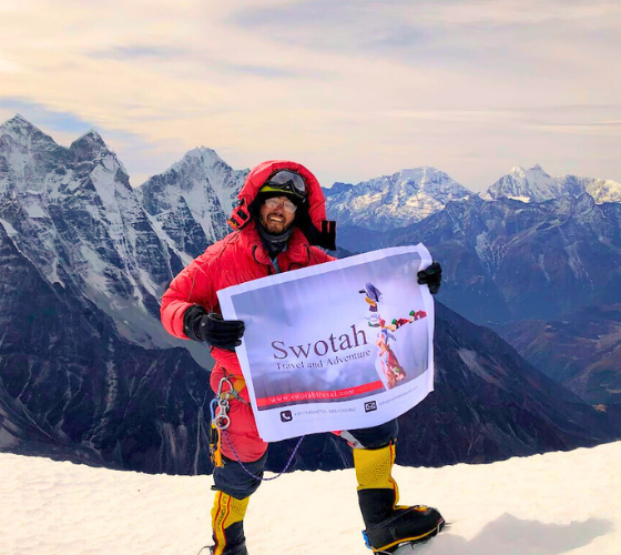

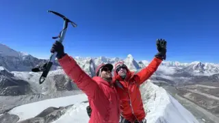

Everest Base Camp Trek Map
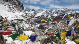
If you're planning the trek to Everest Base Camp (EBC), understanding the terrain, routes, and elevation is key to making your journey as smooth and enjoyable as possible. This map provides an excellent visual overview of all the main trails and landmarks in the Khumbu Valley, nestled within the Sagarmatha National Park, Nepal. In this blog, we’ll break down the map’s most important features, routes, elevation points, and other essential details to help you plan your adventure.
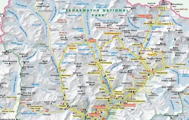
Click to Enlarge EBC Map Click to Enlarge Complete Khumbu Region Map
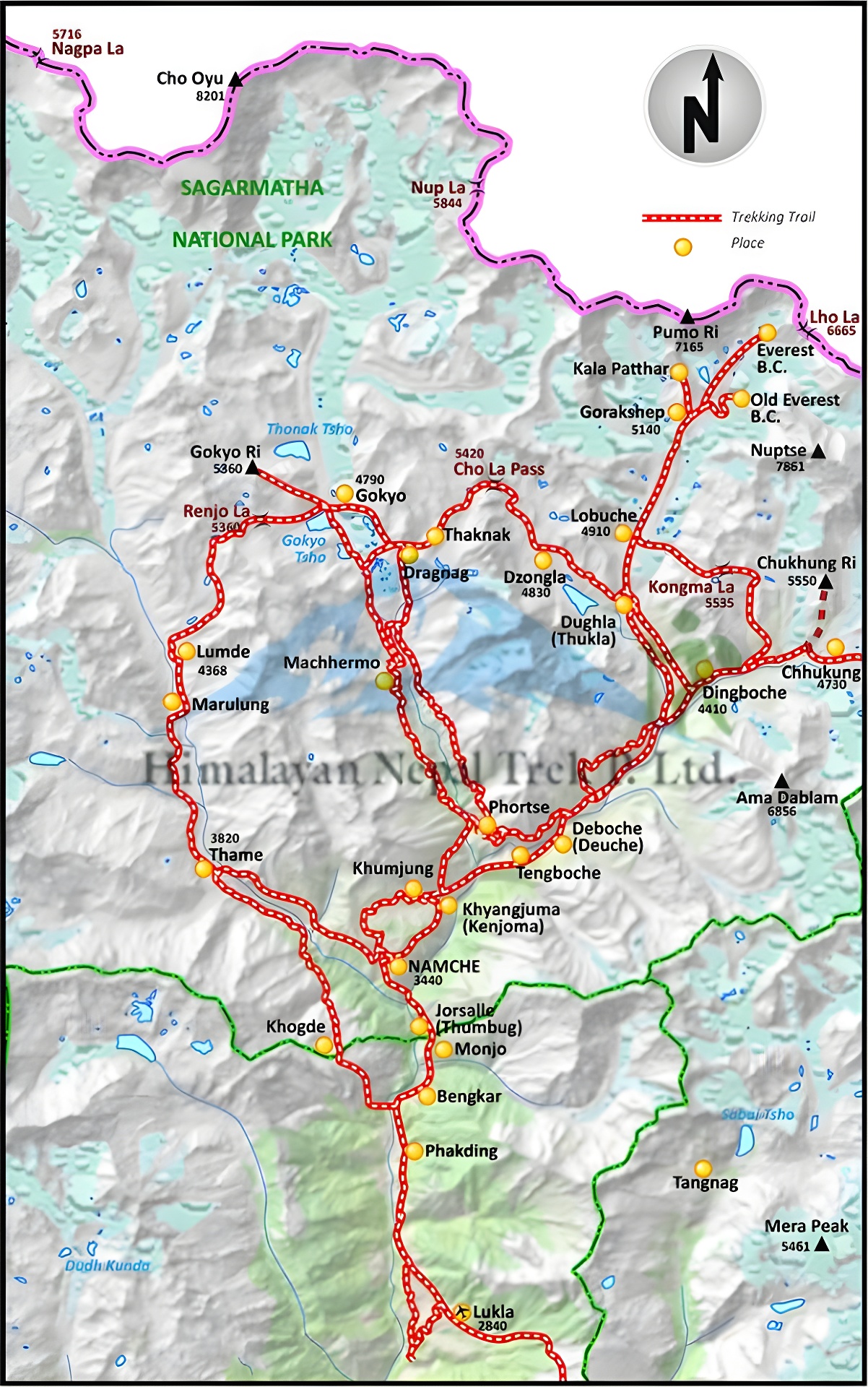
Photo: Everest Base Camp Trek Map
Reading the Everest Base Camp Map
1. The Classic Everest Base Camp Route
The most popular trekking route is clearly marked with red dashed lines on the map. This route starts from Lukla (2,860 meters), the gateway to the Khumbu region, and leads trekkers all the way to Everest Base Camp at 5,364 meters. The route covers several key villages, all of which are identified by orange dots, marking important stops for acclimatization, rest, and cultural exploration.
- Starting Point: Lukla (2,860 meters)
- Key Villages:
- Phakding (2,610 meters)
- Namche Bazaar (3,440 meters) – a crucial acclimatization stop and the largest town in the region.
- Tengboche (3,867 meters) – famous for its monastery and stunning views of the surrounding peaks.
- Dingboche (4,410 meters) – another vital acclimatization spot before heading to higher altitudes.
- Lobuche (4,940 meters) – the last village before the final trek to Gorak Shep and Everest Base Camp.
- Gorak Shep (5,164 meters) – the last settlement before reaching the Everest Base Camp.
The trek follows a gradual ascent to allow trekkers to acclimatize, with green dots indicating recommended stopover points for rest and altitude adjustment.
2. High Peaks and Scenic Highlights
The Everest Base Camp trek offers spectacular views of some of the highest and most famous peaks in the world, many of which are marked on the map with black triangles. Some of the notable peaks visible from the trek are:
- Mount Everest (Sagarmatha) (8,848.86 meters) – the world’s highest mountain, towering over the region.
- Lhotse (8,516 meters) – the fourth-highest peak in the world, located just south of Everest.
- Ama Dablam (6,812 meters) – considered one of the most beautiful mountains, its iconic spire dominates much of the trek.
- Thamserku (6,623 meters) – another stunning peak visible early in the trek from Namche Bazaar.
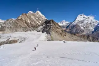
The trek also offers spectacular views of glaciers, including the Khumbu Glacier, which trekkers cross on their way to Gorak Shep and the Base Camp.
3. Alternative Route: Gokyo Lakes and Cho La Pass
For trekkers looking for an alternative or extended adventure, the map also highlights the Gokyo Lakes Route. This route diverges from the main EBC trail at Phortse Tenga, taking you towards the stunning Gokyo Lakes and across the Cho La Pass (5,420 meters), eventually reconnecting with the main route at Lobuche.
- Gokyo Lakes (4,790 meters) – a serene and stunning series of high-altitude lakes offering a peaceful, less-trodden experience compared to the crowded EBC route.
- Gokyo Ri (5,357 meters) – a peak offering panoramic views of Mount Everest and the surrounding giants, often considered one of the best viewpoints in the region.
- Cho La Pass (5,420 meters) – a challenging and technical high-altitude pass connecting the Gokyo and EBC routes.
This route is more difficult due to the crossing of Cho La Pass, but it offers unparalleled scenery, including lakes, glaciers, and some of the best views of Mount Everest.
4. The Three Passes Trek
For the most adventurous trekkers, the map also outlines the Three Passes Trek, which includes three challenging high-altitude passes:
- Kongma La Pass (5,535 meters) – connects Chukhung to Lobuche, one of the highest passes on this trek.
- Cho La Pass (5,420 meters) – links the Gokyo Valley to Lobuche.
- Renjo La Pass (5,360 meters) – leads from Gokyo to Thame, offering incredible views of Everest, Lhotse, and other towering peaks.
This trek takes trekkers through some of the most remote and less-traveled areas of the Khumbu Valley, offering a more isolated and challenging experience. It combines the highlights of the Everest Base Camp trek with the Gokyo Lakes and more strenuous high passes.
5. Key Acclimatization Points
Altitude is a significant challenge on the Everest Base Camp trek, and the map marks several key acclimatization stops. The orange dots on the map indicate the most common locations for resting and acclimatizing:
- Namche Bazaar (3,440 meters) – Trekkers often spend an extra day here to adjust to the altitude before continuing to higher elevations.
- Dingboche (4,410 meters) – Another popular acclimatization stop, providing a chance to rest and prepare for the push to Lobuche and Gorak Shep.
Acclimatization is essential to avoid altitude sickness, and trekkers are encouraged to take their time and follow the map’s recommended stops to ensure a safe journey.
6. Passes and Glaciers
The map highlights several key passes and glaciers along the route. One of the most notable glaciers is the Khumbu Glacier, which trekkers must cross before reaching Gorak Shep and the Base Camp. This glacier is one of the largest in the region and provides a stark and beautiful contrast to the surrounding rocky terrain.
Other notable glaciers include the Ngozumpa Glacier, seen on the Gokyo Lakes trek, the longest glacier in Nepal, and the Imja Glacier near Island Peak.
7. Reaching Everest Base Camp and Kala Patthar
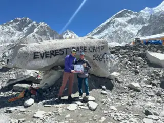
The final goal for most trekkers is reaching Everest Base Camp (5,364 meters), which is clearly marked on the map. This is the starting point for climbers attempting to summit Mount Everest. However, trekkers seeking the best views of Everest often make an additional ascent to Kala Patthar (5,545 meters), a viewpoint marked just above Gorak Shep on the map. From here, you get an unrivalled view of Everest and the surrounding peaks, especially during sunrise.
Everest Base Camp Trek Map (Google Map Route)
Useful Links:
Natgeo Everest Map Online
Everest Base Camp Google Street View
Standard 15 Days Everest Base Camp Trek
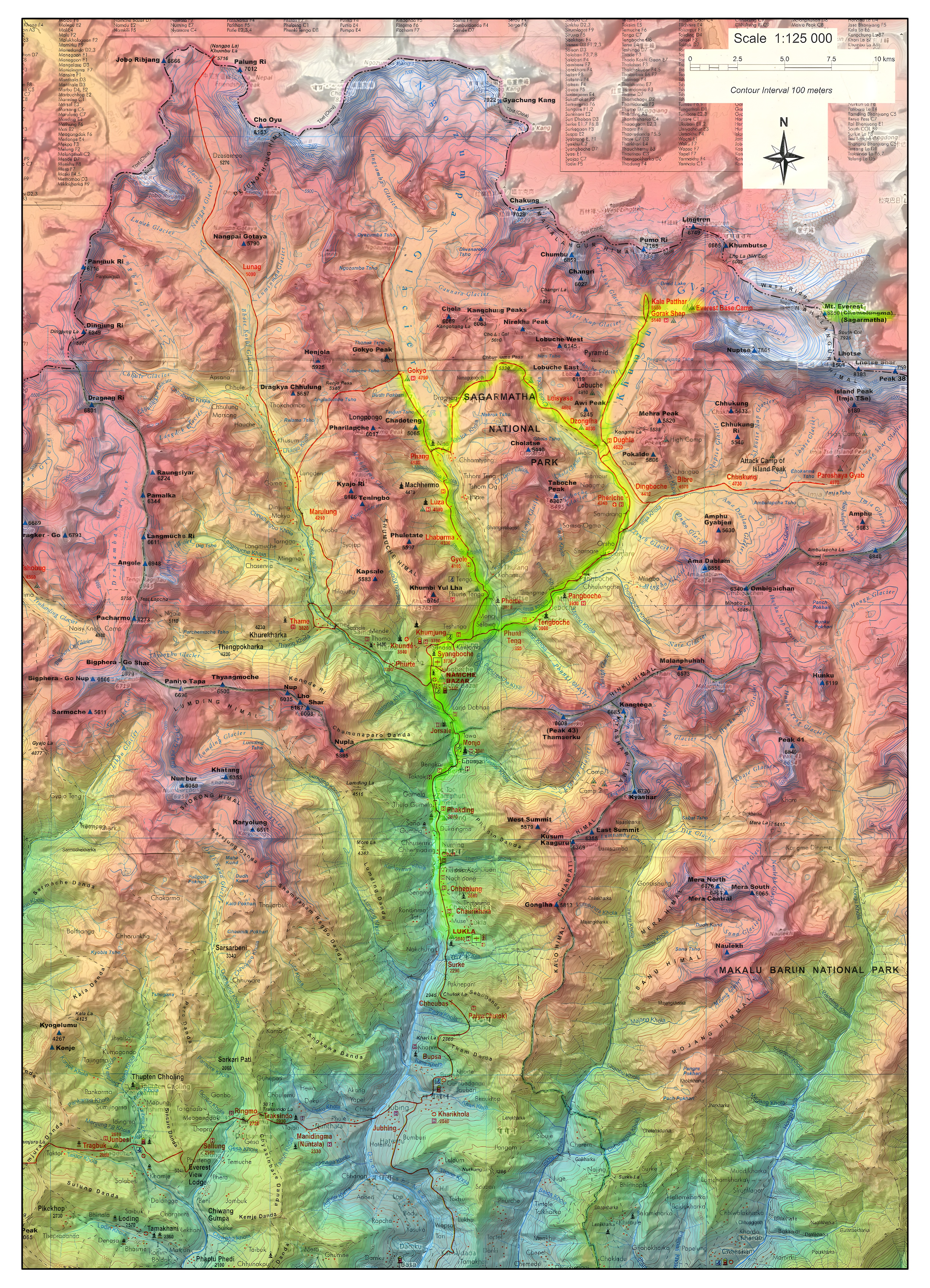
The Everest Base Camp (EBC) trek can be completed within 12 to 18 days, the 15-day itinerary is one of the most popular and balanced options for trekkers. This 15-day itinerary, as depicted in the map below, offers a perfect combination of trekking, acclimatization, and exploration, ensuring that trekkers have enough time to adjust to the altitude and fully enjoy the stunning landscapes of the Khumbu region.

Photo: 15 Days Everest Base Camp Trek Map
The 15-day Everest Base Camp trek follows a well-marked path that begins in Lukla and takes you through the heart of the Khumbu region. The map is divided into key sections, starting with your arrival in Kathmandu and progressing through scenic villages, high passes, and stunning mountain landscapes, all the way to Everest Base Camp (5,364 meters / 17,598 ft) and Kala Patthar (5,545 meters / 18,192 ft).
On the map, you’ll notice the main trekking route is marked in solid blue, which represents the standard trail trekkers follow. The flying route (to and from Lukla) is shown with a dotted blue line.
Key Stops and Elevation Points on the Map
The map provides a clear visual of the entire trek, with key stops highlighted along the way. Here’s a breakdown of the major locations and elevation gains that you’ll encounter on the Everest Base Camp trek:
Day 1-3: Kathmandu to Lukla and Phakding
- Kathmandu (1,400 meters): Your journey begins here. From the capital city, you’ll take a scenic flight to Lukla.
- Lukla (2,860 meters): The trek officially begins in Lukla, as shown on the map, where trekkers take their first steps toward Everest Base Camp.
- Phakding (2,610 meters): A short trek from Lukla leads to Phakding, your first overnight stop.
Day 4-5: Namche Bazaar and Acclimatization
- Namche Bazaar (3,440 meters): Highlighted on the map, Namche is the bustling hub of the Khumbu region. Trekkers spend an extra day here to acclimatize, with options for short hikes to nearby viewpoints and villages like Khumjung.
Day 6: Tengboche
- Tengboche (3,867 meters): This day’s journey takes you through pine and rhododendron forests to the spiritual heart of the trek, Tengboche Monastery, marked on the map. The views of Ama Dablam, Everest, and Lhotse from here are magnificent.
Day 7-8: Dingboche and Acclimatization
- Dingboche (4,410 meters): As you follow the blue trail on the map, you’ll arrive at Dingboche, a village surrounded by beautiful mountain views. Another acclimatization day is spent here, with a popular side hike to Nagarjun Hill marked on the map.
Day 9: Lobuche
- Lobuche (4,940 meters): The trek continues through alpine meadows and glacial moraines, taking you to Lobuche, where you’ll begin to feel the effects of the high altitude.
Day 10: Everest Base Camp
- Gorakshep (5,164 meters): The map highlights Gorakshep, the last village before reaching Everest Base Camp. This is where trekkers leave their gear before continuing to the iconic Everest Base Camp (5,364 meters), shown on the map near the edge of the Khumbu Glacier.
Day 11: Kala Patthar
- Kala Patthar (5,545 meters): The highest point on the trek, Kala Patthar offers some of the best views of Everest and the surrounding peaks. The map shows this as a major viewpoint just before you begin your descent.
Day 12-15: Descent via Pheriche, Namche Bazaar, and Lukla
- The route back is shown retracing your steps through Pheriche, Tengboche, and Namche Bazaar, with the final stop in Lukla, where you’ll catch your return flight to Kathmandu.
Elevation Points and Altitude Insights
The Everest Base Camp trek involves gradual altitude gain, with major rest days for acclimatization, especially in Namche Bazaar and Dingboche. Here's a breakdown of the key elevations:
- Lukla: 2,860 meters – Starting point with one of the world's most famous short runways.
- Phakding: 2,610 meters – A short day to ease into the trek.
- Namche Bazaar: 3,440 meters – A vital acclimatization stop.
- Tengboche: 3,860 meters – Famous for the Tengboche Monastery and great views of Ama Dablam.
- Dingboche: 4,360 meters – Another acclimatization stop surrounded by towering peaks.
- Lobuche: 4,910 meters – The last stop before the final push to base camp.
- Gorakshep: 5,164 meters – The highest village and the staging point for the Everest Base Camp and Kala Patthar summit.
- Everest Base Camp: 5,364 meters – The ultimate destination for trekkers.
- Kala Patthar: 5,545 meters – A popular viewpoint offering some of the best views of Mount Everest.