
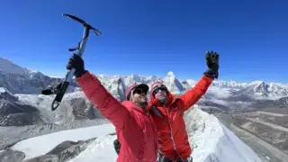
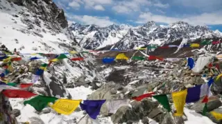


Bhutan is a landlocked Himalayan kingdom of about 38,394 km² between Tibet (China) to the north and India to the south, east and west. In under 200 km the land climbs from about 100 m on the Indian plains to 7,570 m at Gangkhar Puensum, the world's highest unclimbed mountain. Roughly 70% of the country is forest and about half sits inside protected areas and the corridors that link them. For a visitor that means steep valleys, high passes of 3,000 to 4,000 m and towns between about 1,200 m and 2,800 m.
- Area about 38,394 km², 20 districts (dzongkhags)
- Neighbours Tibet (China) north, India south, east and west
- Highest point Gangkhar Puensum, 7,570 m, never climbed
- Lowest point about 100 m, Drangme Chhu on the Indian border
- Forest cover about 70%, with a legal minimum of 60%
- Protected land about 51% including biological corridors
- Main town altitudes Paro ~2,200 m, Thimphu ~2,330 m, Punakha ~1,250 m
- International airport Paro only, with Gelephu under construction
In the early days of 1974, a small country in the Himalayas made headlines worldwide. Bhutan, the land of the thunder dragon, had opened its borders to foreign tourists for the first time, timed with the coronation of the fourth king, and was ready to show off its many charms to an eager international audience. There was just one catch: very few people knew anything about this little-known nation.
This guide covers the geography a traveller actually meets in Bhutan: the mountains, valleys, rivers, glaciers and protected land, plus the facts behind the flag and the people. For entry rules and fees, see our complete guide to travelling to Bhutan.
Physical Geography
Bhutan is a landlocked country in South Asia, bordered by the Tibet Autonomous Region of China to the north and by India to the south, east and west. It covers about 38,394 square kilometres, a little smaller than Switzerland. The capital, Thimphu, sits in the west of the country, and Bhutan is divided into 20 districts called dzongkhags, a name that roughly means "fortress districts" after the dzongs that once governed each one.
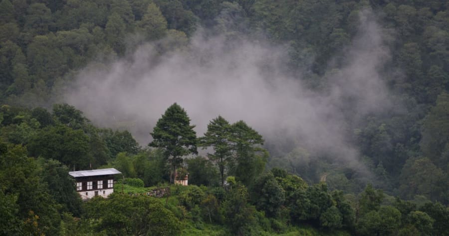
The country's average elevation is often given as about 3,280 metres, which puts it among the highest countries in the world. Over 70% of Bhutan is covered by forest, and the constitution requires that at least 60% stays that way. About 51% of the land sits inside national parks, wildlife sanctuaries, a strict nature reserve and the biological corridors that join them. The landscape is rugged and mountainous, with glaciers in the north and deep river valleys running south.
Bhutan is still hard to reach. It has one international airport, at Paro, set in a narrow valley at about 2,200 metres, and only specially trained pilots fly in. A second international airport is being built at Gelephu in the south, with completion planned for 2029. The Paro valley is also home to the Tiger's Nest monastery, built on a cliff about 900 metres above the valley floor and roughly 15 km north of the airport. It is one of the most visited sites in Bhutan.
Three Climate Zones, Low to High
Bhutan rises so steeply that it fits three climate belts into a strip of land only about 150 to 200 km deep. Where you travel decides what weather you get, and most visitors spend their time in the middle belt. See our guide to the best time to visit Bhutan for month-by-month weather.
| Zone | Altitude | Climate | Where you see it |
|---|---|---|---|
| Southern foothills | about 100 to 1,500 m | Hot, humid, heavy monsoon rain | Phuentsholing, Gelephu, Royal Manas National Park |
| Inner valleys | about 1,100 to 3,000 m | Temperate, warm summers, cool dry winters | Paro, Thimphu, Punakha, Bumthang |
| High Himalaya | above about 3,500 m | Alpine to arctic, snow much of the year | Lunana, Jomolhari and Snowman trek routes |
Altitudes of the Places You Will Visit
Most of the classic western circuit sits between 1,200 and 2,800 metres, and the road passes climb to 3,000 to 4,000 metres. Altitude sickness is rare on the town circuit but possible on high treks and at Chele La.
| Place | Type | Altitude | Height |
|---|---|---|---|
| Punakha | Town and dzong | about 1,250 m | |
| Paro | Town and airport | about 2,200 m | |
| Thimphu | Capital | about 2,330 m | |
| Jakar, Bumthang | Town | about 2,600 m | |
| Dochula | Road pass, Thimphu to Punakha | about 3,100 m | |
| Pele La | Road pass, west to central Bhutan | about 3,420 m | |
| Chele La | Road pass, Paro to Haa | about 3,988 m |
Altitudes are approximate and vary slightly between sources. Gangkhar Puensum, at 7,570 m, is off this scale: Bhutan banned climbing on peaks above 6,000 m in 1994 out of respect for local beliefs, and it was closed to all mountaineering in 2003, so it remains unclimbed.
The National Flag
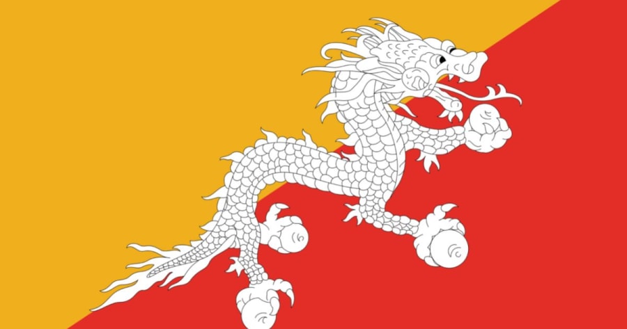
The flag is divided diagonally into two halves, yellow in the upper corner and orange in the lower. The yellow stands for the secular authority of the king, which is why the king wears a yellow scarf. The orange stands for Buddhism and the monastic tradition. Across the line between them runs Druk, the white thunder dragon that gives Bhutan its local name, Druk Yul. Its place on the dividing line shows that civil and religious traditions carry equal weight. The dragon is white for purity, and the jewels clasped in its claws stand for the wealth and security of the country.
The People and Where They Live
Geography has shaped who lives where. The 2017 census counted about 727,000 people, and current estimates put the population at around 790,000 to 800,000. The Ngalop, of Tibetan origin, live mainly in the west. The Sharchop are the main group in the east, alongside smaller indigenous communities in remote valleys. The Lhotshampa, of Nepali origin, live mostly in the southern foothills. Official breakdowns by group are not published, so any percentages you see are estimates.
About three quarters of Bhutanese follow Buddhism, mainly the Drukpa Kagyu school, which is the state religion, and the Nyingma school. Around 22 to 23% are Hindu, mostly Lhotshampa in the south, with small Bon and other minorities. The national language is Dzongkha, but linguists count about 19 languages spoken across the country, most of them Tibeto-Burman, plus Nepali in the south. Steep ridges kept valleys apart for centuries, which is one reason so many languages survived.
Glaciers of Bhutan
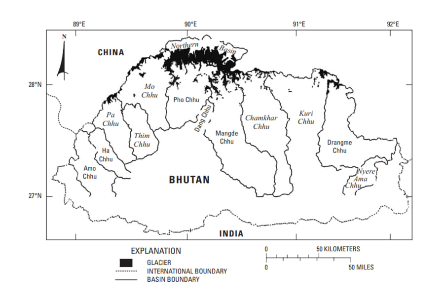
Glaciers are often seen on mountaintops and flanks along the main topographical ridge of the Bhutan Himalayas and on plateaus and ridges extending south from the central Himalayan divide. Most of Bhutan's glaciers drain south, feeding rivers that flow down to India. A small area on the northern flank of the main divide, known as the Northern Basin, drains the other way, north into Tibet.
The upper valleys of the southernmost valley glaciers are narrow and steep, whereas those on the northern side have broad and sloping accumulation regions. In the US Geological Survey's glacier atlas of Bhutan (USGS report), the longest glacier listed is 20.1 km, in the Pho Chhu basin, and the largest single glacier area, 99.7 km², is on the north side of Table Mountain (Zongophu Gang). The accumulation areas of the Table Mountain glaciers form an ice field on the north sides of the mountain, which is known as the North Slope.
Glacial Lakes and Flood Risk
Counts depend on how a glacial lake is defined. The 2001 ICIMOD inventory listed 2,674 glacial lakes, 24 of them potentially dangerous. A later inventory by Bhutan's National Center for Hydrology and Meteorology (NCHM), which counts only lakes near glaciers, found 567 glacial lakes covering about 55 km², and flagged 17 as potentially dangerous.
These glacier lakes can be categorized according to their location and function. Location-wise, they are either found in the main valley glaciers or on the flanks of the mountains. Concerning function, some glacial lakes fill up with melted water and become sources of rivers, while others simply act as reservoirs for excess water during the rainy season.
Bhutan's glaciers are shrinking as the climate warms. Bhutan has plenty of water overall, but much of it arrives in the monsoon, and farming, which still employs a large share of the population, and hydropower both depend on steady flows from snow and ice in the dry months.
As glaciers retreat, some moraine-dammed lakes grow, and a few have burst. The best known is Lugge Tsho in Lunana, which broke out on 7 October 1994 (some studies say 6 October). The flood ran down the Pho Chhu, killed about 21 people and damaged Punakha Dzong, about 100 km downstream. It led to the lake surveys, early-warning sirens and engineering work that continue in the Punakha valley today.
The Pho Chhu sub-basin above Punakha holds many of the lakes rated most hazardous. Thorthormi, at the head of the Pho Chhu, is the largest at about 4.2 km², and a 2024 study estimated that a breach could put more than 1,200 buildings downstream at risk.
The Wang Chhu basin, which drains Paro and Thimphu, has far fewer lakes of concern than the Pho Chhu.
Rivers
Bhutan's rivers are fed by glaciers, snowmelt and monsoon rain, so they swell in summer and shrink in winter. They all run roughly north to south and join the Brahmaputra in India. From west to east the main rivers are the Amo Chhu (Torsa), the Wang Chhu (Raidak), the Puna Tsang Chhu (Sankosh), the Mangde Chhu and the Drangme Chhu, the last two joining as the Manas.
The Drangme Chhu and Manas system in the east and centre drains the largest share of the country. The Wang Chhu (Raidak) drains the western valleys of Haa, Paro and Thimphu, and the Puna Tsang Chhu (Sankosh) is formed at Punakha, where the Pho Chhu and Mo Chhu meet beside Punakha Dzong.
The Manas reaches the plains through Royal Manas National Park on the Indian border. Paro International Airport sits in the Wang Chhu basin, on the Paro Chhu.
These rivers are Bhutan's biggest export earner, as hydropower sold to India. The theoretical potential is often put at about 30,000 megawatts. The 1,020 MW Punatsangchhu-II plant on the Puna Tsang Chhu came fully online in 2025, taking installed capacity to roughly 3,500 MW, still only a fraction of the potential.
National Parks and Protected Areas
About 51% of Bhutan is protected. The network has five national parks, four wildlife sanctuaries and one strict nature reserve, linked by biological corridors that let animals such as tigers and elephants move between them.
| Area | Type | Known for |
|---|---|---|
| Jigme Dorji National Park | National park | The largest park, covering the north-west, Jomolhari and snow leopard country |
| Wangchuck Centennial National Park | National park | The north-centre, headwaters of several major rivers |
| Jigme Singye Wangchuck National Park | National park | Central Bhutan's Black Mountains, next to the Phobjikha valley |
| Phrumsengla National Park | National park | Temperate forest along the road east of Bumthang |
| Royal Manas National Park | National park | Subtropical forest on the Indian border, home to tigers, elephants and golden langur |
| Jigme Khesar Strict Nature Reserve | Strict nature reserve | Haa district in the far west, closed to tourism |
| Bumdeling, Sakteng, Jomotsangkha, Phibsoo | Wildlife sanctuaries | Black-necked cranes at Bumdeling, highland herders at Sakteng, lowland forest in the south |
Bhutan's Borders
Bhutan's northern border with China has never been fully demarcated, and the two countries have been negotiating it for decades without formal diplomatic relations. The best-known disputed area is the Doklam plateau in the far west, where Chinese and Indian troops faced each other for about ten weeks in 2017. None of this affects normal tourist routes, which stay well inside the country.
Why the Geography Matters for Your Trip
Bhutan's geography is characterized by its high mountains, which comprise most of the country. Several large rivers cut deep north to south valleys, so most travel runs along valleys and over passes rather than straight across the country. Its glaciers feed those rivers, and as they shrink, glacial lake floods have become a real concern in valleys such as Punakha.
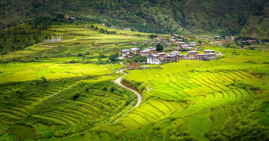
For a traveller, the practical effects are simple. Road journeys are slow because of the switchbacks, so a drive of 70 km can take three hours. Flights into Paro depend on clear weather. And a single trip can take you from rice terraces at Punakha to snow on Chele La in the same week.
Geography is the reason Bhutan feels the way it does. See how to experience it in our guide to the things to do in Bhutan and our 10 surprising Bhutan facts.
Frequently Asked Questions
Where is Bhutan located?
Bhutan is in the eastern Himalayas in South Asia, between the Tibet Autonomous Region of China to the north and India to the south, east and west. It does not border Nepal. The Indian state of Sikkim lies between them.
How big is Bhutan?
About 38,394 square kilometres, a little smaller than Switzerland, with a population of around 800,000.
What is the highest mountain in Bhutan?
Gangkhar Puensum, at 7,570 m. It is the highest unclimbed mountain in the world because Bhutan does not allow climbing on its high peaks.
How much of Bhutan is forest?
About 70%. The constitution requires Bhutan to keep at least 60% of its land under forest for all time.
Is Bhutan at high altitude?
The main towns sit between about 1,250 m (Punakha) and 2,600 m (Bumthang), so altitude sickness is uncommon on a standard tour. Road passes reach about 4,000 m at Chele La, and treks such as Jomolhari go much higher.