
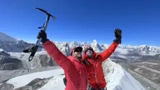
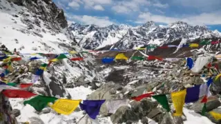


Tilicho Lake sits at about 4,919 m in Manang district and is a side trip of 3 to 4 days from Manang on the Annapurna Circuit. You walk to Khangsar, then Shree Kharka (about 4,060 m), cross a landslide-prone slope to Tilicho Base Camp (about 4,150 m), and climb about 800 m to the lake and back the next morning. There are simple lodges, so no camping is needed. Most people then rejoin the circuit at Yak Kharka and cross the Thorong La (5,416 m). You need only ACAP and TIMS, arranged through an agency with a licensed guide, and the best months are March to May and late September to November.
- Lake altitudeAbout 4,919 m (16,138 ft)
- Base campAbout 4,150 m, simple lodges
- Side trip from Manang3 to 4 days
- Climb on lake dayAbout 800 m up and back
- PermitsACAP + TIMS, guide required
- Best monthsMar to May, late Sep to Nov
Real travellers rarely sit still. They lead a nomadic life throughout their lives. Most of them are simply itching for an adventure. Travelling is the only solution if you want to explore new places and see amazing things. Trekking is one of the means to get you adventure and provide you with the thrill of the world's beauty. And the world offers you thousands of destinations to grab the opportunity. Out of them, we've found the perfect destination, the Tilicho Lake trek.
This trekking guide will take you on a wild journey to one of the most beautiful lakes in the world. With huge landscapes and plenty of challenges, this trek is perfect for anyone looking for an adventure.
So what are you waiting for? Let's get started!


Highlights of Tilicho Lake Trek
- Visit Tilicho Lake (about 4,919 m), often described as one of the highest lakes of its size in the world.
- Enjoy close views of the Annapurna massif, Dhaulagiri, Manaslu, and other Himalayan giants.
- Traverse through varied landscapes, including lush forests, arid mountain deserts, and rocky trails.
- Experience the rich culture of the local communities, including Gurung, Thakali, and Manangi ethnic groups.
- Tackle the challenge of crossing the Thorong La Pass, one of the highest and most famous passes in the world.
- Visit ancient Buddhist monasteries and learn about the spiritual practices of the local communities.
- Trek on less crowded trails that provide a more solitary and serene hiking experience compared to other parts of the Annapurna region.
- Experience clear night skies perfect for stargazing, especially from the higher lodges.
Profile Of The Trek
|
Name |
Tilicho Lake |
|
District |
Manang |
|
Former development region |
Western (development regions were replaced by provinces in 2015) |
|
Province |
Gandaki |
|
District Headquarters |
Chame |
|
Distance |
About 55 km in a straight line from Pokhara, about 6 to 8 hours' walk from Khangsar via Shree Kharka |
|
Topography |
High-Altitude Lake |
|
Altitude |
4,919 m / 16,138 ft (some surveys give 4,949 m) |
|
Latitude |
28° 41' 30" North |
|
Longitude |
83° 51' 10" East |
|
Length |
About 4 km |
|
Breadth |
About 1.2 km |
|
Area |
4.8 sq. Km |
|
Average depth |
About 85 m |
|
Water quality |
Pure fresh |
|
Source |
Tilicho, Mesokanto and Idam-Phra Peaks |
|
Mountains |
Tilicho, Nilgiri range, Muktinath Himal, Idam-Phra, Pushen Dada and Annapurna Range |
|
Flora |
Lonicera Spinosa, Oxygraphis, Alpine Buttercup, Alpine Austragulas, Caragina, Prinirose, Primulagentian, Edelweiss etc |
|
Fauna |
Snow Leopard and Blue Sheep |
|
Avifauna |
Himalayan Snow Cock, Alpine Chough, Demoiselle Crane (migratory) |
|
Herbs |
Cordyceps sinensis, Picrorhiza scrophulariiflora, Dactylorhiza hatagirea, spikenard, etc. |
|
Aquatic Organism |
None recorded (Department of Hydrology and Meteorology, 2003) |
|
Climate |
Alpine |
|
Climate Zone |
Rain Shadow |
|
Vegetation |
Alpine |
|
Glacier |
Tilicho Glacier |

Overview of the Tilicho Lake Trek
The Tilicho Lake Trek is a hiking expedition that will take you to one of the highest lakes of its size in the world. At 4,919 meters above sea level, Tilicho Lake is a sight to behold. The route also gives wide views of the Annapurna range and, on the way out, Dhaulagiri.
The classic route begins at Besisahar, a town in Lamjung, though most groups now drive further up the Marsyangdi valley to Jagat, Dharapani or Chame and start walking there. After an initial ascent, your first destination is Tal (1700 m), and Chame is the next. From there, you will hike to Pisang, at 3,200 to 3,300 meters (Lower and Upper Pisang). You will then trek to Manang at 3,540 meters and on to Khangsar at about 3,750 meters. During your trip, you will pass through the villages of Ngawal, Mungji and Braka. Along the way you see Annapurna, Gangapurna, Pisang Peak, and Tilicho Peak up close.
From Khangsar, your next stops are Tilicho Base Camp and Tilicho Lake. The trail climbs to the yak pastures of Shree Kharka (about 4,060 m), then crosses a steep, landslide-prone slope to Tilicho Base Camp (about 4,150 m). Tilicho Lake sits at 4,919 m, and the slopes around it are steep, so take this part slowly.
After the lake you walk back past Shree Kharka toward Yak Kharka and Thorong Phedi, then cross the Thorong La (5,416 m). Then you make your way to Muktinath, a sacred place for Hindu and Buddhist people. From Muktinath, you will trek to your last destination, Jomsom, from where you fly or drive back to Pokhara.
The full route usually takes around 12 to 14 days of trekking. Swotah's version runs 20 days from Kathmandu and exits over Poon Hill.

Detail Itinerary for Tilicho Lake Trek
Day 1: Besisahar to Tal
The journey will begin in the early morning in Kathmandu (the capital of Nepal). There, we will take a bus and reach Besisahar after 6 to 7 hours. Along the bus ride, you will see some amazing scenery along the Trishuli and Marsyangdi valleys. From Besisahar, we will go on a rough road via a jeep to reach Bulbule. From Bulbule, we will start our trek and reach the Tal village, where we will rest for the day. Today many groups ride a jeep further up the valley to Jagat, Dharapani or Chame, which saves a day of walking on the road.

Day 2: Tal to Chame
The next day, we will start our trek from Tal and reach the headquarters of Manang district, Chame. Along the trek to Chame, we will be in the Annapurna region and will be able to see the beautiful Annapurna mountains, cross the Marsyangdi River, and visit other beautiful villages. Chame is also the place to buy all the necessary items you may need to buy or have repaired.

Day 3: Chame to Pisang
From Chame, we will trek through lush green pine forests and walk alongside the Marsyangdi river. We will pass the large apple farm at Bhratang. After a few hours, we will reach Dhikur Pokhari(3060m). From Dhikur Pokhari, we will cross a Suspension Bridge and reach a village. There, we will rest for some time and then trek to Upper Pisang.

Day 4: Trek from Pisang to Manang
There are two trekking routes from Pisang to reach Manang. One way is to go through Ghyaru, where there are more climbs, and another way is through the southern route, which has less climbing than the Ghyaru route. Both routes will end up at the same place called Mungji. Along the way, we will be able to see different snow peaks, such as Tilicho Peak, Annapurna Peak, and many others. We will also go through beautiful Tibetan villages, monasteries, and beautiful landscapes. Trekking through all these places after 6-7 hours, we will reach our destination for the day in Manang.

Day 5: Acclimatization Day
Today, we will stay in Manang to acclimate. We will do a short hike around Manang, buy necessary things, and rest for the days ahead. The usual acclimatisation walks climb to the Gangapurna Lake viewpoint or Praken Gompa and come back down to sleep.
Day 6: Manang to Khangsar Trek
Full of energy, we will now begin our trek to Khangsar. We will trek through the alpine forest surrounded by snow-peaked mountains and then cross the Kangsar River to reach the Khangsar village.

Day 7: Trek from Khangsar to Tilicho Base Camp
Leaving the Khangsar village, we will begin our trek. Along the trek, we will see Yak grazing and blue sheep. The first part of the trek is quite a climb up to Shree Kharka, so we will trek slowly. After Shree Kharka the trail crosses a steep slope of loose scree where rocks fall, so we cross it in the morning before the wind picks up. We will spend the night in one of the simple lodges at Tilicho Base Camp.

Day 8: Tilicho Base Camp to Tilicho Lake and Back to Tilicho Base Camp
Today is the day when we will reach our destination, Tilicho Lake. It's a steep and hard climb of about 800 m, often on snow from late autumn to spring. Along the way, we will be able to see mountains such as Tilicho Peak and Gangapurna. So after a hard climb, we will reach Tilicho Lake at an altitude of 4,919 m. After admiring the beautiful lake and its surrounding view, we will return to the Tilicho Base Camp and rest. Overnight at a base camp lodge.

Day 9: Tilicho Base Camp to Khangsar
Now it's time to return. We will now trek our way back to Khangsar from the same way we came through and then reach Khangsar.
Day 10: Khangsar to Yak Kharka
From Khangsar we will trek to Yak Kharka. Yak Kharka is a small settlement located at an altitude of about 4,050 meters (13,287 feet). It is known for its views of the surrounding mountains, including Annapurna II, Annapurna IV, Gangapurna, and Tilicho Peak. While trekking, we will see monasteries and yak grazing, cross the Thorong River, and reach Yak Kharka.

Day 11: Yak Kharka to Thorong High Camp
Leaving the Yak Kharka, ascending through Ledar, descending to the trail, and reaching Thorong Phedi. Along the trail, we will get to see small tea houses where we can rest and have a cup of tea. We will also get a close-up view of Thorong Peak and a beautiful landscape. Overnight stay on Thorong High Camp.

Day 12: Trek to Muktinath (Via Thorong La Pass)
Crossing through one of Nepal's highest passes, the 'Thorong La Pass,' which lies at an altitude of 5416m, we will reach Muktinath, also known as the Mukti Kshetra, which means salvation arena. This is going to be a tough trek, so we have to make sure that we trek slowly, rest along the way, and drink plenty of water.

Day 13: Trek to Jomsom
First, we will visit the Muktinath temple, have some breakfast, and start our trek to Jomsom. Along the Kali Gandaki river, we will walk with a view of Mt Dhaulagiri and the villages below it, cross many suspension bridges, and then reach Jomsom, the headquarters of Mustang district. This is the end of the trek. Many trekkers now ride the jeep from Muktinath to Jomsom instead of walking.

Day 14: Jomsom to Pokhara
Now that our trek has ended, we will go to Pokhara. There are two ways to reach Pokhara: by flight or bus. It's better to take a flight because the Bus journey is rough and super long. After reaching Pokhara, we will stay there, and the next day, we will go to Kathmandu, where you can take a flight or a bus, depending on your budget or time. From Kathmandu, you will then depart for your home country.
Preparing for the Tilicho Lake Trek
Now that you have all the necessary information, it's time to start preparing for your trek. While there's no one right way to do this, here are a few tips to help you get started:
First, ensure you're physically and mentally prepared for the challenge ahead. Trekking at high altitudes can be strenuous, especially if you need to get used to it. Start by doing some hikes or walks in the weeks leading up to your trek. This builds the leg strength and stamina you need. Only time spent high up helps you acclimatise, which is why the itinerary includes a rest day in Manang.
Secondly, pack appropriately. You'll need plenty of clothes for both warm and cold weather, as well as sturdy shoes that can handle a variety of terrain. Don't forget sunscreen, insect repellent, and a hat to protect you from the sun and bugs. And remember to pack your sense of adventure!
Finally, familiarize yourself with the route before you go. There's nothing worse than getting lost in the middle of nowhere. Study the map, even though a licensed guide is now required on this route.
Essential Gear for the Tilicho Lake Trek
You'll need a few pieces of essential gear for the Tilicho Lake Trek. Make sure you have a good backpack, sleeping bags, sturdy hiking shoes, water and snacks, and rain gear.
A good backpack is vital-you'll want something roomy enough to fit all your gear but not too heavy that it becomes a burden. Make sure your shoes are well-worn and waterproof- the terrain can be unpredictable, and you don't want wet feet for the entire trek. And finally, don't forget snacks and water-you'll need the energy to get to the top and want to stay hydrated along the way.
It's also important to pack wisely. Leave room in your backpack for souvenirs, and be mindful of your weight so you don't tire yourself out before you even start the trek.
Tilicho Lake Route and Altitude Profile
The table below follows the usual line from Manang to the lake and back onto the circuit. Altitudes are rounded, because lodge signs and maps disagree by 50 m or more. For the whole loop, see our Annapurna Circuit trek map.
| Stop | Altitude | Note |
|---|---|---|
| Manang | 3,540 m | Acclimatisation day |
| Khangsar | 3,750 m | Last proper village |
| Shree Kharka | 4,060 m | Yak pastures, lodges |
| Tilicho Base Camp | 4,150 m | After the scree traverse |
| Tilicho Lake | 4,919 m | Day hike, back to base camp |
| Yak Kharka | 4,050 m | Rejoin the circuit |
| Thorong Phedi | 4,540 m | Foot of the pass |
| Thorong La | 5,416 m | Highest point |
| Muktinath | 3,710 m | Temple town |
The Shree Kharka to Base Camp Traverse
The one stretch that worries guides sits between Shree Kharka and Tilicho Base Camp. The trail cuts across a steep slope of loose scree, and stones come down most often in the afternoon, when the wind rises and the sun loosens the rock. Cross it early in the morning, keep moving through the marked danger zone, don't stop for photos there, and leave space between people. After heavy rain or fresh snow, ask at Shree Kharka before you set off.
Lake day itself starts in the dark. You climb about 800 m on zigzags from base camp, which usually takes 3 to 4 hours up and about 2 hours down. Wind on the shore picks up by late morning, so most groups start down before midday.
Ways Out After the Lake
Almost everyone walks back toward Shree Kharka and takes the high path to Yak Kharka, then goes on to Thorong Phedi and over the Thorong La to Muktinath. A few camping groups cross the Mesokanto La, a high pass above the lake whose height is given anywhere from about 5,100 m to 5,300 m, straight down to Jomsom. It has no lodges and needs a full camping crew, good weather and pass experience, so treat it as an expedition and check with your agency first.
Tilicho Compared With Nepal's Other Famous Lakes
| Lake | Altitude | Region |
|---|---|---|
| Tilicho Lake | 4,919 m | Manang, Annapurna |
| Gokyo (Dudh Pokhari, at the village) | 4,790 m | Khumbu, Everest region |
| Gosaikunda | 4,380 m | Langtang National Park |
| Rara Lake | 2,990 m | Mugu, Nepal's largest lake |
| Phewa Lake | 742 m | Pokhara |
Several smaller glacial lakes in Nepal sit higher, so Tilicho is best described as one of the highest lakes of its size rather than the highest lake. It measures about 4 km by 1.2 km and averages about 85 m deep. In 2000 a Russian team dived in it, which was recorded at the time as the highest-altitude scuba dive.
Hindus link the lake with Kak Bhusundi, the sage who, in the Ramayana, told the story to Garuda while in the form of a crow. That's why some pilgrims combine Tilicho with Muktinath on the same trip.
Pit Stops and Highlights on the Tilicho Lake Trek
There are plenty of highlights and pit stops along the way to Tilicho Lake. Here are a few of the most popular ones:
The apple orchards of Marpha
Just south of Jomsom, the stone-paved village of Marpha is Nepal's apple capital. Treat yourself to fresh apple pie, dried apples, and the famous local apple brandy as a post-trek reward.
Muktinath Temple
This holy temple is a popular stop for Hindu and Buddhist pilgrims. It's situated at an altitude of about 3,710 meters (12,170 feet), so you'll feel like you're on top of the world!
Thorong La Pass
This is the highest point on the Annapurna Circuit Trek, and at an altitude of 5,416 meters (17,769 feet), it's not for the faint of heart. But trust me, the views from the top are 100% worth it.
Permit required for Trekking in Tilicho Lake
Just like the Annapurna circuit permit, two permits are needed for trekking in Tilicho Lake. They are a TIMS (Trekker Information Management System) card and an ACA (Annapurna Conservation Area) permit. The TIMS card will cost around 2000 NRS, and the ACA will cost around 3000 NRS.
Since April 2023 both are arranged through a registered agency, and a licensed guide is required. Buy ACAP in Kathmandu or Pokhara, because it costs double (NPR 6,000) at a trail checkpoint. SAARC nationals pay NPR 1,000 for each. Tilicho itself needs no extra permit, so the two cards cover the whole circuit. Our Annapurna Circuit permit guide has the details.
Cost Of Trekking In Tilicho Lake
All the costs that you may end up with while trekking in Tilicho lake are given below:
Flight to Nepal
Prices for flights to Nepal can vary depending on factors such as the time of year, the airline, and how far in advance you book. It is generally a good idea to book your flights as far in advance as possible to get the best price. You may also be able to find discounts or special deals on flights by looking for promotional offers or by being flexible with your travel dates. For reference, a flight ticket from the USA to Nepal generally costs around $2000 to $3000.
Visa
The cost of a Nepal visa depends on the type of visa you are applying for and how long you plan to stay in the country.
Tourist visas are available for visitors who are coming to Nepal for tourism purposes. The cost of a single-entry tourist visa is $30 for a 15-day stay, $50 for a 30-day stay, and $125 for a 90-day stay.
Visa fees are subject to change, so you should check with the Embassy of Nepal or the Department of Immigration in Nepal for the most up-to-date information.
Gear and Equipment
The cost of gear and equipment for trekking in Nepal can vary significantly depending on a number of factors, including the type of trek you are planning to do, the time of year, and the quality and brand of the gear you are purchasing.
For trekking in Tilicho Lake, all the gear and equipment, assuming you don't have any, can cost around $300 to $500.
You can often rent or hire gear and equipment in Nepal, which can be a cost-effective option if you do not want to purchase everything yourself. Renting or hiring gear and equipment can also be a good option if you are only planning to do a short trek or if you are not sure if you will be doing more trekking in the future.
The cost of renting or hiring gear and equipment in Nepal can vary, but you can expect to pay anywhere from a few hundred to a few thousand rupees per day, depending on the type of gear you are renting and the length of the rental period.
In general, it is a good idea to do some research and compare prices before purchasing or renting gear and equipment for your trek in Nepal. You may also be able to find discounts or special deals by shopping around or by looking for promotional offers.
Food and water
Food and water get more expensive the higher you go, because everything above Manang arrives by jeep or mule. Plan on roughly USD 20 to 35 per day, or about USD 300 to 450 over a 14-day trek.
Accommodation
Just like in every other trek of Nepal, such as Annapurna trekking, assuming you will eat the food in the accommodation you will be staying at. Rooms cost about USD 5 to 10 a night, and some lodges discount the room if you eat dinner and breakfast there. Over 14 nights that comes to roughly USD 70 to 140.
Transportation
Vehicle
From Kathmandu to Besi Sahar, the bus price will be around $20 to $30, and the jeep price to Bulbule will be around $10. If you were to take a bus from Jomsom to Pokhara instead of taking a flight, it would cost you around $12-$20.
Flight
Prices for flights can vary depending on the time of year, demand, and availability. You can check with individual airlines or online travel agencies to find the best price for your specific travel dates. Foreign passengers pay about USD 105 to 125 one way from Kathmandu to Pokhara, and about USD 115 to 160 from Jomsom to Pokhara. Morning wind in the Kali Gandaki valley cancels Jomsom flights often, so keep a spare day.
Guide and Porter
The job of a guide or Porter is to guide the trekker, help them, give information about the terrain, mountains, and places, and carry their bag pack. Note that since April 2023, a licensed guide is mandatory on the Annapurna Circuit, including the Tilicho side trip, so plan on trekking with one. The guide will cost about USD 25 to 40 per day, and the porter about USD 20 to 25 per day.

Insurance
Buy travel insurance for your trek in Nepal to protect against any unforeseen circumstances, such as medical emergencies, trip cancellations, or lost or stolen belongings. When looking for travel insurance, you should consider what type of coverage you need based on your specific needs and the activities you will be participating in during your trek.
Some things to consider when purchasing travel insurance for your trek in Nepal include:
Medical coverage
Make sure you have adequate medical coverage for any injuries or illnesses that may occur during your trek. This is especially important if you are planning to participate in high-altitude trekking, as the risk of altitude sickness and other medical emergencies is higher in these areas.
Trip cancellation coverage
If you need to cancel your trek due to unforeseen circumstances, such as a medical emergency or natural disaster, trip cancellation coverage may allow you to recoup some of your costs.
Lost or stolen belongings coverage
It's a good idea to have coverage for any valuable items you may bring with you on your trek, such as cameras, electronics, or jewelry.
Emergency evacuation coverage
This type of coverage can be helpful if you need to be evacuated from the trek due to an injury or illness. Check that the policy covers trekking to at least 5,500 m, because the Thorong La is 5,416 m, and that it pays for helicopter rescue. Our trekking insurance guide explains what to look for.
Many travel insurance providers offer coverage for treks in Nepal, so it's a good idea to shop around and compare policies to find the one that best meets your needs. It's also a good idea to read the fine print carefully and understand what is and is not covered under the policy. Generally, the insurance will cost you anywhere from $100 to $1000, depending on the type of insurance.
Total Cost
|
Flight Ticket |
Depending on your country |
|---|---|
|
Visa |
15 Days- $30, 30 Days- $50, 90 Days- $125 |
|
Gear |
Around $500 (If you don't own the gear) $100 (if rent) |
|
Permits |
ACAP - NPR 3,000 (about $20), TIMS - NPR 2,000 (about $13) |
|
Food and water |
Around $20 to $35 a day depending on your food choice |
|
Accommodation |
Around $5 to $10 per night |
|
Transportation |
$100 to $175 (Public) |
|
Flight Ticket inside Nepal |
About $115 to $160 per flight (Jomsom to Pokhara) |
|
Insurance |
$100 to $1000 depending on the type of insurance |
|
Guide |
About $25 to $40 per day |
|
Porter |
About $20 to $25 per day |
With a licensed guide now required, a self-organised Tilicho trek realistically costs about USD 900 to 1,500 per person for the trek itself, before international flights, visa, insurance and gear. A porter adds about USD 280 to 350 for 14 days. These are rough figures built from the ranges above, so check current prices before you budget.
| Trek cost (per person) | Range |
|---|---|
| Licensed guide, 14 days | USD 350 to 560 |
| Food and water, 14 days | USD 300 to 450 |
| Transport in Nepal (road and Jomsom flight) | USD 150 to 300 |
| Lodging, 14 nights | USD 70 to 140 |
| Permits (ACAP + TIMS) | About USD 37 |
Best Time To Trek The Tilicho Lake
Trekking Tilicho all year round is possible, but some months the weather can be bad, or the trek might become hard, and some months it can be pretty crowded. So, if we were to consider all these things, the months of March to May or September to November are the best times to trek the Tilicho lake.
From about December to March, snow can block the trail above base camp and the lake freezes over. In the monsoon (June to August) the Shree Kharka traverse is at its most exposed to rockfall, and cloud often hides the peaks.
Challenges and Risks of the Tilicho Lake Trek
Even though the Tilicho Lake Trek has been gaining popularity, it's still a relatively challenging and remote trek. As such, there are a few things you should be aware of before undertaking the journey.
First of all, while the trail has been cleared and is well-marked, some sections are still steep and rocky. And, since you'll be trekking at a high altitude, you can expect cold weather and potentially hazardous conditions, even in the summer months.
Secondly, since Tilicho Lake is off the beaten path, there are limited options for accommodation and food. Shree Kharka and Tilicho Base Camp have simple lodges, so you don't need to camp, but rooms fill fast in October and dorms are basic.
Finally, while the views from Tilicho Lake are huge, it's important to remember that this is a natural environment. Be sure to pack out all your trash and follow Leave No Trace principles to help keep this special place beautiful for future generations.
Tips and Strategies for a Successful Tilicho Lake Trek
Here are a few tips and strategies to help make your Tilicho Lake trek a successful one:
- First, start your trek well-rested and with plenty of energy. This trek is not for the faint of heart, and you'll need all the stamina you can muster.
- Second, take your time. There's no need to rush. Enjoying the scenery is half the fun.
- Third, come prepared. Make sure you have all the necessary gear, including proper clothing and footwear, a map, and enough food and water to last you the entire journey.
- Fourth, be aware of your surroundings at all times. Tilicho Lake is a beautiful but dangerous place, and it's essential to stay safe.
- Finally, have fun! This is supposed to be an adventure, after all. Embrace everything that Tilicho Lake offers, and you will surely have an unforgettable experience.
Taken together, the Tilicho Lake trek is an amazing experience that will leave you with memories to last a lifetime. The region's natural beauty is hard to match, and the opportunity to see such an unspoiled part of the world is a rare privilege. If you're looking for an adventure that will take you off the beaten path, this trek is definitely for you.
If you're dreaming of an unforgettable adventure to the majestic Tilicho Lake, let Swotah Travel turn that dream into reality. We plan the route, permits, lodges and acclimatisation days, and we'll guide you every step of the way, from the Marsyangdi valley to the lake shore. Get in touch and we'll help you plan it.
Tilicho Lake Trek: FAQs
How high is Tilicho Lake?
About 4,919 m (16,138 ft), though some surveys give 4,949 m. Base camp is about 4,150 m, so lake day is a climb of roughly 800 m.
Do I need to camp at Tilicho Base Camp?
No. Shree Kharka and Tilicho Base Camp both have simple lodges with dorms and a few private rooms. They fill up in October, so a guide usually calls ahead.
Do I need a special permit for Tilicho Lake?
No. The ACAP and TIMS card you need for the Annapurna Circuit cover the Tilicho side trip. Since April 2023 both go through an agency, and a licensed guide is required.
Is the Tilicho Lake trek dangerous?
The main risks are altitude and the rockfall-prone traverse between Shree Kharka and base camp. Cross that section early in the morning, take the acclimatisation day in Manang, and turn back if headache or nausea gets worse.
How many extra days does Tilicho add to the Annapurna Circuit?
Usually 3 to 4 days from Manang: Khangsar or Shree Kharka, base camp, the lake day, and the walk across to Yak Kharka.