


The Kanchenjunga trek is a two-and-a-half to four-week trip to the base camps of the world's third-highest mountain (8,586 m) in Taplejung, far-east Nepal. You can go to North Base Camp at Pangpema (about 5,143 m), to South Base Camp at Ramche and Oktang, or link both on a circuit over the Sele La passes. It is a restricted area. You need a restricted area permit (USD 20 a week for the first four weeks), the Kanchenjunga Conservation Area Permit (NPR 2,000) and a licensed guide, and no TIMS card. Teahouses now cover both routes. The best months are October to November and March to May.
- Highest pointPangpema North Base Camp, about 5,143 m
- Trek length15 to 18 days south, 20 to 23 north, 24 to 30 for both
- TrailheadTaplejung or Suketar, about 2,420 m
- PermitsRestricted area permit + KCAP, no TIMS
- GuideLicensed guide required, one-person permits allowed since March 2026
- Best monthsOctober to November, March to May
- LodgingBasic teahouses on both routes
Everyone knows Mount Everest and the Everest Base Camp Trek, but did you know there are other equally amazing treks in the northeast of Nepal?
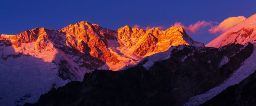
Mount Kanchenjunga lies on the border between Sikkim, India, and Nepal. On the Nepal side, it is in Taplejung District in the far east of the country. At 8,586 m it is the third-highest mountain in the world.
This area has three main treks: Kanchenjunga South Base Camp, Kanchenjunga North Base Camp, and the Kanchenjunga Circuit, which covers both base camps. Swotah runs the circuit as the Kanchenjunga Base Camp Trek.
Most groups fly from Kathmandu to Bhadrapur in the eastern lowlands, a flight of under an hour, then drive 8 to 10 hours on mountain roads to Taplejung or Suketar. Nepal Airlines also flies a small Twin Otter from Kathmandu straight to Suketar airstrip (about 2,420 m) a few days a week. Fog shuts that strip often. In 2026 it reopened in late September after a gap of about four months, so treat the direct flight as a bonus and keep a spare day either way.
This area did not open to trekkers until the late 1980s. It is protected by the Kanchenjunga Conservation Area, declared in 1997 and handed to local community management in 2006. This means the area has pristine flora and fauna unique to this part of the country.
Difficulty
While there are less strenuous treks such as the Annapurna Trek, and there are even easy walking tours in Nepal, you need a pretty good level of fitness for the Kanchenjunga area. I would recommend previous trekking experience to tackle any of these routes. Plan on about 15 to 18 days for South Base Camp, 20 to 23 days for North Base Camp and 24 to 30 days for the full circuit, counting the travel days to and from Kathmandu.
Kanchenjunga Route Options at a Glance
| Route | Typical days | Highest point | What it suits |
|---|---|---|---|
| South Base Camp (Ramche and Oktang) | 15 to 18 (Swotah: 21) | Oktang viewpoint, about 4,730 m | Shorter trip, forest, the Yalung Glacier |
| North Base Camp (Pangpema) | 20 to 23 | Pangpema, about 5,143 m | The big north face view, out and back up the Ghunsa valley |
| Circuit, both base camps | 24 to 30 (Swotah: 30) | Pangpema, about 5,143 m | The full traverse, with the passes between Ghunsa and Cheram |
How to Decide Which Trek to Do?
If you have enough time, even the longer trek is possible, then you can base your decision on what interests you.
The Kanchenjunga South Base Camp trek explores the Yalung Glacier and climbs through pristine forests, agricultural fields, and villages. Most groups sleep at Ramche (about 4,580 m) and walk up to the Oktang viewpoint (about 4,730 m), a ridge with close views of the Kanchenjunga south face and other peaks. Highlights include learning about the lifestyle of the Rai and Limbu people and walking through the Kanchenjunga Conservation Area. This area also falls under the Sacred Himalayan Landscape initiative of the World Wild Life Fund (WWF). It is home to snow leopards, red pandas, and Asian black bears, and much more. There is plenty to see for bird lovers, including the golden-breasted fulvetta.
The Kanchenjunga North Base Camp trek also offers views of snow-capped mountain peaks, subtropical lowlands, rhododendron and alpine forests, and glaciers. The base camp itself is at Pangpema (about 5,143 m), reached by a high track following the moraine of the Kanchenjunga Glacier. The base camp sits above the glacier and offers close views of the north face of Kanchenjunga and Yalung Kang. Highlights of this trek include alpine meadows, high-altitude wetlands and glaciers on the lap of the mountain. Plus, meeting Limbu and Rai villagers lower down and Sherpa families at Ghunsa.
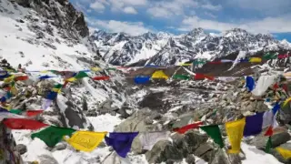
The Kanchenjunga Circuit trek visits both the north and south base camps. The landscape here is filled with rivers, waterfalls, rhododendrons and pine forests, the Yalung Glacier, and green meadows. And of course, mountains! Highlights here include the glacial lakes, diverse flora and fauna, the gompa at Ghunsa and the prayer flags and chorten at Oktang.

Each trekking route brings you close to amazing mountains. Kanchenjunga has five summits: the main summit, three more above 8,000 m (Yalung Kang 8,505 m, South 8,494 m and Central 8,482 m) and Kangbachen at 7,903 m. There are also around twenty other peaks above 7,000 m, Jannu (7,710 m) among them. Plus many peaks over 6,000m and five major glacial systems, three of which flow into Sikkim while the waters of the Kanchenjunga and Yalung glaciers flow into the Tamor River in Nepal.
Definitely, you are in the heart of less visited mountains and glaciers in this region. What an experience!
Find out more about these treks here.
Kanchenjunga Circuit Altitude Profile
The circuit climbs the Tamor and Ghunsa valleys to Pangpema, comes back down to Ghunsa, crosses a string of passes to Cheram, then visits the south side before dropping out through Yamphudin. Heights below are approximate, and sources differ by up to 150 m for some stops.
| Stop | Altitude | Height |
|---|---|---|
| Suketar | about 2,420 m | |
| Chiruwa | about 1,270 m | |
| Amjilosa | about 2,395 m | |
| Gyabla | about 2,730 m | |
| Ghunsa | about 3,595 m | |
| Kambachen | about 4,050 m | |
| Lhonak | about 4,780 m | |
| Pangpema (North Base Camp) | about 5,143 m | |
| Passes between Ghunsa and Cheram | about 4,650 m | |
| Cheram | about 3,870 m | |
| Ramche | about 4,580 m | |
| Oktang viewpoint (South Base Camp) | about 4,730 m | |
| Yamphudin | about 2,080 m |
What do you Need to Go to the Kanchenjunga Area?
As I said, having some trekking knowledge and experience would be sensible before setting out to this remote area. And please note, this is not an area you can go to alone. You must go through a trekking agency for your safety and because it is a restricted area.
Permits: A restricted area entry permit is required, which is issued in Kathmandu. Since March 22, 2026, even solo trekkers can obtain the restricted area permit (USD 20 per person per week), provided a licensed guide accompanies them. The old two-trekker minimum is gone. After four weeks the rate rises to about USD 25 per person per week. You also need the Kanchenjunga Conservation Area Permit (NPR 2,000, about USD 13). No TIMS card is needed, because the restricted area permit replaces it. The full 2026 rules are in our Kanchenjunga permit 2026 guide, and every region is covered in our trekking permits guide.
| Permit or rule | 2026 cost or status |
|---|---|
| Kanchenjunga restricted area permit | USD 20 per person per week for the first four weeks, then about USD 25 per week |
| Kanchenjunga Conservation Area Permit (KCAP) | NPR 2,000 (about USD 13), flat |
| TIMS card | Not required |
| Licensed guide | Required. One trekker can now hold the permit alone |
| Typical total for a four-week circuit | About USD 95 per person in permits |
What is the Best Time to Visit Kanchenjunga Area?
Spring, March to May, is one of the two good windows. Mornings are clear and the rhododendron forests flower lower down. Afternoon cloud builds as May goes on, and snow can still sit on the passes between Ghunsa and Cheram in March.
Late December to early March is very cold, and some teahouses/ lodges will be closed. The Sele La passes will be extremely hard to find as they will be under snow. The ground will be slippery with snow and proper winter wear (including crampons) are required. This time is most suited to those experienced to trekking in snow conditions.
June to mid-September is the monsoon season with lots of clouds and rain. When not raining, however, the skies will be very blue! Watch out for leeches! Landslides are common in this season and the trail slippery. Be aware rain can make you feel less than enthusiastic on the trails and less willing to get out of bed in the morning!
October and November are the most reliable months. The monsoon has cleared, the air is fresh and the mountains stand out sharp. Early December stays clear but the nights get very cold.
How Busy Is the Kanchenjunga Trek?
Quiet, by Nepal standards. Kantipur reported about 1,400 foreign visitors to the Kanchenjunga region in its latest yearly count (April 2026), a small fraction of the numbers on the Everest and Annapurna trails. In peak October you will share lodges at Ghunsa and Ramche with a handful of other groups. Outside the season, some days you will meet nobody at all, which is part of the appeal and also the reason a guide matters when the next village is a long day away.
How is the Accommodation?
While some areas like the lower altitudes of the Everest Treks, have quite luxurious lodges, both routes now have teahouses at the usual overnight stops, mostly simple stone lodges with shared rooms and short menus. You only need a tent for side trips or if a lodge is shut for the season, so check this with your Nepal travel agency before setting off. In some areas there is better accommodation, but do not expect much in the way of luxury in the more remote areas!
How is the Food?
As on most treks in Nepal Dal bhat is always on the menu! As this is an area closer to Tibet Thukpa (a Tibetan noodle dish) is also a staple. Unlike places like the treks around Annapurna western food is not readily available. Bring snacks with you.
What Should I Take with Me?
There is pretty much a standard for all treks list of stuff to take with you, which I will list below. But there are a few other things to take into remote areas.
A portable solar panel to recharge your electronics as there is limited or no electricity in this area. For those areas with electricity, bring an adapter that fits any kind of socket.
Phone networks do not work in some areas so some kind of device for basic messaging in emergency situations would be useful.
Packing List for Trekking in Kanchenjunga
Basically - layers! While daytime will be hot and sunny on some treks, mornings and evenings can be extremely cold – and anything in between!
-
Sun lotion
-
Sun glasses – even when not sunny, you are often at high altitude when the effects of the sun’s rays are stronger.
-
Sun hat
-
A warm hat for cold weather. You may even need it in bed too.
-
Buff or scarf. Buff is easier to carry, and you can use it for other things too i.e., mask, headband.
-
When buying/ packing underwear go for something that is both quick drying (for washing on the trail) and which absorb moisture from your body.
-
Trekking shirts* are great because they are especially made for keeping you dry on treks. I suggest 3 or 4 of these for longer treks.
-
Fleece jacket* for warmth.
-
Jacket for over the fleece such as a down jacket*
-
Rain jacket* for the obvious!
-
Rain over-trousers if trekking in the monsoon season
-
Trekking trousers and shorts* – again those made specifically for trekking are best
-
Gloves – both inner gloves and thicker insulation gloves if you are going very high or into snowy conditions
-
Hiking socks – again 3 or 4 pairs
-
Hiking boots – wear them in before going on the trek!
-
Footwear like trainers or sandals for in the lodges and to give your feet a rest from the boots
-
Good backpack and day pack
-
Sleeping bag** and inner sleeping bag/sheet
-
Quick drying towels
-
Hiking poles*
-
Headlight – easier to use than the traditional hand-held torch
-
Feminine hygiene products
-
Wet wipes – maybe not many showers on the way or too cold to strip off to use them.
-
Water purifier tablets or Life Straw
-
Your usual toiletries like lip balm and toothpaste
-
Any medicines you usually use as well as a basic first aid kit
-
Passport/ money/ insurance
*You can buy in Kathmandu on your arrival
** You can hire in Kathmandu. Some trekking agencies will provide a sleeping bag for their clients.
Let’s Go!
Hopefully, this guide will give you some idea about the Kanchenjunga treks and help you decide if this area is for you. Please discuss further with your Nepal tour agency and put Kanchenjunga on your list of top things to do in Nepal!
Kanchenjunga Trek FAQs
How many days is the Kanchenjunga trek?
About 15 to 18 days for South Base Camp, 20 to 23 for North Base Camp and 24 to 30 for the full circuit, including travel to and from Kathmandu. Swotah's South Base Camp trip is 21 days and the circuit is 30.
Can I trek Kanchenjunga without a guide?
No. It is a restricted area and a licensed guide from a registered agency is compulsory. Since 22 March 2026 one trekker can hold the permit alone, but the guide still has to come along.
How much do Kanchenjunga permits cost in 2026?
The restricted area permit is USD 20 per person per week for the first four weeks, then about USD 25 a week. The conservation area permit is NPR 2,000. A four-week circuit comes to roughly USD 95 per person.
Do I need a TIMS card for Kanchenjunga?
No. The restricted area permit replaces it.
Is the Kanchenjunga trek suitable for beginners?
Not really. The days are long, the trail is remote, and North Base Camp sits above 5,100 m. Do at least one multi-day trek at altitude first, such as Everest Base Camp or Annapurna Base Camp.