

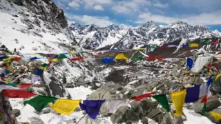

Makalu Region
Sankhuwasabha, eastern Nepal
The fifth-highest mountain on Earth, 19 km east of Everest, and a near-perfect four-sided pyramid. The base camp trek climbs from 435 m of tropical lowland to 4,870 m, which is one of the longest altitude gradients on any single Nepali trail.
Trips Starting from Makalu Region
Hand-crafted itineraries that start in Makalu Region, from a single sunrise day-trip to multi-week Himalayan expeditions.
A Pyramid Unlike Any Other
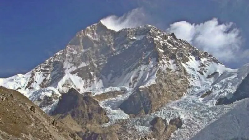
Makalu reaches 8,485 m just 19 km east of Everest, making it the fifth-highest mountain on Earth. The name comes from the Sanskrit Maha Kala, a name of Shiva meaning great black. What sets it apart visually is its shape: where most Himalayan giants present a jumble of ridges and subsidiary summits, Makalu is a clean four-sided pyramid, recognisable from every angle in the Barun valley.
Lionel Terray and Jean Couzy summited on 15 May 1955 for a French expedition, and then the entire team followed over the next three days, which was exceptional for the period. The region is protected by Makalu Barun National Park, 1,500 km² that adjoins Sagarmatha National Park to form one unbroken stretch of protected Himalaya across the border with Tibet.
The base camp trek runs 18 to 21 days and starts in tropical lowland at 435 m, finishing at 4,870 m. That gradient is the trek's character: you begin among rice terraces and Rai bamboo villages, climb through some of Nepal's best rhododendron forest, and end in the upper Barun looking at Everest's east face, Lhotse, and the cathedral-like Chamlang. Fewer trekkers walk it in a year than reach Everest Base Camp in a good week. See eastern Nepal for the region around it.
Things to do in Makalu Region
Standout experiences hand-picked by our local guides.
- 01Makalu Base Camp4,870 m, facing the south-west face. One of the most striking single-mountain views in Nepal.
- 02Barun ValleyA glacier-walled valley whose upper meadows carpet with wildflower in spring.
- 03ShersonAn optional climb to about 5,300 m from base camp for Everest's east face, a view very few people see.
- 04Rai and Sherpa VillagesBamboo-built Rai villages low down at Tashigaon and Khongma, Sherpa Buddhist settlements higher.
- 05Shipton LaA 4,210 m pass over the ridge above Khongma, named for the British explorer Eric Shipton.
- 06Rhododendron ForestSome of Nepal's finest, between 2,000 and 3,500 m on the approach. Solid colour through April.
- 07ChamlangA 7,319 m satellite peak whose west face dominates the upper valley.
- 08TumlingtarThe Arun valley airstrip where every Makalu trek starts. The flight in skirts Everest's eastern flank.
Best time to visit Makalu Region
The enormous altitude gradient needs settled weather at both ends. Autumn is the most reliable; spring gives you the rhododendron.
- ★ BEST SEASONSpringMarch – MayRhododendron turns the forest pink and red through April. Expect snow above 3,500 m until May. Drier of the two seasons on the approach.-5°C – 18°C
- MONSOONSummerJune – AugustMonsoon. Leeches, mud and landslides on the steep lower forest. There is no case for walking this trek in it.8°C – 22°C
- ★ BEST SEASONAutumnSeptember – NovemberPeak season. Clear days, stable weather and the mildest nights you will get at base camp. The best window for the views this trek exists for.-12°C – 15°C
- MONSOONWinterDecember – FebruaryThe upper trail becomes impassable with snow and base camp closes. The lower Rai villages remain visitable.-25°C – 5°C