


Nepal Flood 2026: What Trekkers Need to Know
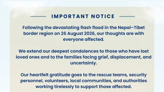
A glacier collapse north of Langtang Lirung sent a flash flood down the Bhotekoshi and Trishuli rivers on the morning of 26 August 2026, and as of 7 September 2026 Nepal Police had recovered 1,353 bodies and listed 3,992 people as unaccounted for, with the toll still expected to move; the flood also destroyed 42 kilometres of the road to the Tibet border. The flood ran 72 kilometres through Rasuwa and Nuwakot. It did not touch Everest, Annapurna, Manaslu, Pokhara or Kathmandu, all of which are running normally. The Trishuli corridor itself is a different matter. A second lake dammed up behind debris on the Tibetan side after the flood, and the river has been under a standing flood warning since 27 August. If you are trekking in Nepal this autumn, the practical question is narrow: does your route pass through the Trishuli corridor or start at Syabrubesi? For most trekkers the answer is no, and nothing changes. This page sets out which routes are affected, what has changed in the days since, what is still unresolved about Langtang, and what to do if you already have a booking.
\n\nIs it still safe to trek in Nepal?
\n\nNepal has eight trekking regions of any scale, and the 26 August flood reached one of them. The Bhotekoshi flood was a localised event confined to a single river system in the country's north-centre. That distinction matters, because "Nepal flood" headlines carry no geography, and travellers reading them from abroad have no easy way to tell whether a disaster sits 15 kilometres from their trailhead or 300.
\n\nRasuwa district is the affected area, and it is roughly 60 kilometres north of Kathmandu. The Everest region sits about 140 kilometres east of it. Annapurna and Pokhara sit about 100 kilometres west. Neither watershed connects to the Trishuli, so neither received any of the floodwater. Trails, lodges and airstrips in both regions were reported undamaged.
\n\nThe honest caveat is that this is a fast-moving situation and the assessments are days old. Survey teams have not walked every trail in Rasuwa. Treat anything below as current to 8 September 2026, read the developments section for what has changed since the flood itself, and check again before you fly.
\n\nWhat happened on 26 August
\n\nAt 02:52 UTC, which is 08:37 in Nepal, part of an unnamed glacier north of Langtang Lirung broke away and fell several hundred metres. The ice melted from the friction and velocity of its own impact. The collapse was violent enough to register as a magnitude 5.2 seismic event on instruments in Germany and the United States, which is how the timing is known so precisely.
\n\nThe resulting surge travelled 72 kilometres down the Bhotekoshi into the Trishuli, through Rasuwa and Nuwakot districts and on into Gyirong county on the Tibetan side. Nepal's Department of Roads confirmed the entire 42 kilometre road from Betrawati to the Rasuwagadhi border crossing was destroyed at multiple points. A further 16 kilometre stretch nearer the border, recently rebuilt with Chinese financing, was also swept away.
\n\n41 bridges were damaged or carried off, along with the customs post at Rasuwagadhi and more than 300 vehicles. Six hydropower facilities were hit, removing 431 MW from the national grid, with a further 470 MW of projects under construction damaged. Because the road itself is gone, most of the rescue effort has had to run by helicopter.
\n\nNepal Police's count for the evening of 6 September, released in the early hours of 7 September, put the toll at 1,353 bodies recovered and 3,992 people unaccounted for. The dead toll has climbed every day since the flood - 389 on 27 August, 469 on 28 August, 626 on 29 August, 987 on 1 September and past 1,300 by the first week of September - while the missing count has been falling as reconciliation between district, police and family records moves names off the list. The Nepal Army has separately estimated that around 121 people remain trapped, rather than confirmed dead, in flooded hydropower tunnels along the Trishuli. People were killed across the border in Gyirong county in Tibet as well, where several hundred more remain unaccounted for.
\n\nFigures for missing travellers vary by source, mostly because the sources are counting different things. The Nepal Tourism Board initially reported roughly 400 tourists out of contact. Nepal Police said on 28 August that 644 of the people listed as missing are foreign nationals, and separate compilations put the number at 668 foreign tourists from 34 countries alongside 127 Nepali domestic tourists. Reconciliation of who was actually in the valley is still going on, so treat all of these as provisional.
\n\nIf you are trying to trace someone who was in the area, Nepal's Ministry of Foreign Affairs runs an emergency control room for foreign nationals on +977 9744441227 and +977 9744441228, by phone or WhatsApp between 07:00 and 22:00 Nepal time. The full list of channels, including embassy contacts, is in our Rasuwa flood update.
\n\nWhat has changed since 26 August
\n\nFour developments since the flood change what a trekker needs to know, and they point the same way. The Trishuli corridor is still an active recovery and hazard zone rather than a cleanup site.
\n\nA second lake formed upstream and the river is under a standing warning
\n\nChina informed Nepal through the Ministry of Foreign Affairs on 27 August that two rivers near the head of the Bhotekoshi had been blocked by debris, with a lake filling behind it. Nepal's Flood Forecasting Division issued a special alert, and more than 679,000 warning messages went to people living along the Trishuli in Rasuwa, Nuwakot, Dhading and Chitwan. Rasuwa's Chief District Officer said on 28 August that the Nepali Army had reported the lake breaching. It did not produce a second surge on the scale of the 26 August flood, but the alert has not been lifted. Stay off the banks of the Bhotekoshi, Trishuli and Narayani until it is.
\n\nThe search has moved a long way downstream
\n\n233 of the bodies recovered so far were found in Chitwan and a further 158 in Nawalparasi East, more than 100 kilometres below where the flood came down. Those riverbank stretches are working search areas, not scenery. That matters for two things trekkers do routinely on either side of a trek: rafting the Trishuli, which is off, and road transfers that run along the river.
\n\nThe road north is still closed
\n\nNo part of the 42 kilometre Betrawati to Rasuwagadhi road has reopened to tourist traffic, and no reopening date has been set. Until it does, Langtang, Gosaikunda and Tamang Heritage stay unreachable whatever condition their own trails turn out to be in.
\n\nA second highway is now cut, well south of the flood itself
\n\nOn 30 August the Prithvi Highway collapsed at Krishnabhir in Dhading, more than 60 kilometres downstream of Rasuwa, after the swollen Trishuli undercut the road bed: 70 metres of highway are gone and a further 120 metres are cracked. This is a separate closure from the Rasuwagadhi road and it blocks the main Kathmandu-Pokhara route for standard road transfers, not just trekking access to the north. A temporary bypass track is being cut into the hillside above the collapse and was reported more than two-thirds complete as of early September, with the Prime Minister pledging it would reopen within September, but engineers have since warned fresh cracks above the works mean it will not hold as a permanent fix. Fly Kathmandu to Pokhara or Bharatpur rather than plan a road transfer on this route for now.
\n\nWhich trekking routes are closed
\n\nSix areas along the flood corridor should be treated as closed to trekkers and rafters. These are active recovery zones with search teams working in them, and the access roads are broken.
\n\n- \n
- Rasuwagadhi and the Kerung border crossing. The customs post and its bridges are gone. The crossing is shut, with no reopening date set, which also closes the overland route to Kailash and the Tibet trade road. \n
- Timure. One of the worst affected settlements on the river. Recovery work is ongoing. \n
- Syabrubesi. Heavy damage to riverside buildings and services. This is the ordinary road head for Langtang, which is why its condition matters beyond the village itself. \n
- The Betrawati to Rasuwagadhi road. 42 kilometres destroyed at multiple points. There is no reliable vehicle access north. \n
- The Tamang Heritage Trek. The route runs through the Bhotekoshi and Timure corridor the flood came down. Treat it as closed until surveyors have walked it. \n
- Trishuli rafting and the riverside camps. The rafting sections between Kathmandu and Pokhara, and the camps along them, are off. The corridor is under a flood warning and search teams are working the banks. \n
- The Prithvi Highway at Krishnabhir. Collapsed on 30 August, well south of Rasuwa. A bypass track is under construction but the road is not open; fly Kathmandu to Pokhara or Bharatpur instead. \n
Langtang and Gosaikunda: the unresolved cases
\n\nThe Langtang Valley Trek is the one route where the picture is genuinely unsettled, and it deserves more than a yes or no. Two rivers meet at Syabrubesi. The Bhotekoshi, which carried the flood, comes down from the north. The Langtang Khola, which the trekking trail follows east towards Kyanjin Gompa, is a different river and did not carry the surge.
\n\nThat geography is the reason reports conflict. The upper Langtang trail above the confluence was not in the flood path, and there is no verified report of the trail from Syabrubesi to Kyanjin Gompa being destroyed. The problem is access rather than the trail itself: Syabrubesi is reached by the Pasang Lhamu Highway, and that road is damaged and currently closed to tourist traffic. A trail you cannot reach is closed in practice, whatever its own condition.
\n\nThere is a second reason for caution that has nothing to do with the road. The glacier that failed sits north of Langtang Lirung, which is the peak at the head of the Langtang valley itself. The barrier lake that formed and then breached upstream in the days after 26 August is the practical demonstration of why that matters, because the catchment is still producing new hazards days after the event. Until glaciologists have assessed what remains of that ice mass and whether more of it is unstable, upper-valley routes near it warrant a formal hazard assessment rather than an optimistic reopening. Gosaikunda sits in the same catchment and carries the same caveat.
\n\nOur position is conservative. We are not operating Langtang, Gosaikunda or Tamang Heritage departures until the road is reopened and a competent authority has assessed the upper valley. We would rather move your dates than be first back in.
\n\nWhich regions were not affected at all
\n\nKathmandu is 60 kilometres south of the affected valley and was not touched. Hotels, restaurants, domestic flights and city services are operating normally, and Tribhuvan International Airport has run without interruption throughout.
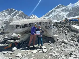
\n\nThe Everest region reported no flood damage on the main trekking routes. Lukla, Namche Bazaar and the trail to Base Camp are unaffected, and the Everest Base Camp Trek is running to schedule. The Khumbu drains through the Dudh Koshi, a separate river system entirely.
\n\nThe Annapurna region is likewise clear. The Annapurna Base Camp Trek and the Annapurna Circuit reported no trail damage from this event, and Pokhara, the staging city for both, was not directly affected. The Manaslu Circuit is intact, though Gorkha district was placed under a flood warning downstream and it is worth confirming road conditions on the drive in.
\n\nChitwan and Lumbini reported no impact on their tourism areas, and the national park, the lodges and the jungle activities are running. Two cautions apply to Chitwan. 233 bodies have been recovered in the district and the flood alert still stands, which makes the Narayani riverbank a search and warning zone rather than somewhere to walk. And the Prithvi and Tribhuvan highways carry traffic that also uses parts of the Trishuli corridor, so confirm the highway status before a road transfer rather than assuming it.
\n\nOur team is safe
\n\nEvery member of the Swotah team is accounted for and safe, along with the guides and porters who were on the ground with our groups. We had no clients on the affected routes when the flood came down.
\n\nSeveral of our staff have relatives in the districts the flood ran through, and some are volunteering with relief efforts this week. If your enquiry takes a little longer to answer than usual over the next few days, that is why.
\n\nIf you have a Nepal trip booked this autumn
\n\nThe autumn trekking season runs from mid-September to late November and is the busiest of the year. Bookings for it are already made, which is why the timing of this flood matters more than the size of the affected area suggests.
\n\nCheck three things in order. First, does your itinerary include Langtang, Gosaikunda, Tamang Heritage, or an overland Tibet or Kailash leg through Rasuwagadhi? If yes, it needs rerouting. Second, does any road transfer use the Trishuli corridor, which includes some Kathmandu to Chitwan and Kathmandu to Pokhara road routes? While the flood warning stands, fly it rather than drive it. If you have to go by road, confirm the highway status on the day. Third, if neither applies, your trip is very likely unchanged.
\n\nTrekkers holding Langtang permits should know that permit offices can reissue for a different region rather than refund, so ask before cancelling anything. If you booked with us, write to us and we will tell you plainly whether your route is affected and go through the options with you before you cancel anything.
\n\nHow to help, and the one place to send money
\n\nThe Prime Minister's Disaster Relief Fund is the Government of Nepal's official mechanism for disaster donations, run by the Office of the Prime Minister. By statute the money can only fund rescue, treatment, relief, rehabilitation and reconstruction. It cannot be spent on administrative costs, and the accounts are audited annually.
\n\nNepal Clearing House opened the fund's gateway to international donors this week at pmdrf.nchl.com.np, which now accepts foreign cards alongside Nepali mobile banking, connectIPS and wallets. Fraudulent appeals referencing this flood are already circulating on social media and messaging apps, and we are deliberately not linking to any private fundraiser because we cannot verify them. Check the address bar reads pmdrf.nchl.com.np before entering card details. Full payment details are on our Rasuwa flood update page.
\n\nSwotah collects, holds and forwards none of this money. The link goes straight to the government portal.
\n\nWhere to check before you travel
\n\nNepal's National Disaster Risk Reduction and Management Authority publishes the official casualty and damage figures, and its numbers supersede anything in this article. The Department of Hydrology and Meteorology publishes the flood forecasts and warnings for the Bhotekoshi and Trishuli, which is the one to watch while the barrier lake alert stands. The Department of Roads issues highway status updates, and the Nepal Tourism Board publishes travel advisories for visitors.
\n\nYour own government's travel advice is worth reading alongside those, though foreign advisories tend to lag local conditions by several days and often describe whole countries rather than districts. For route-level questions about a specific trek, ask an operator who is actually in Kathmandu and can call the road head.
\n\nWe will update this article as survey teams report and as roads reopen. When Langtang is genuinely walkable again we will say so here, and not before.