


Where Is Mount Everest? Exact Location, Coordinates and How to Get There
Mount Everest sits on the border between Nepal and the Tibet Autonomous Region of China, at 27.9881° N, 86.9250° E. The summit is in the Mahalangur Himal sub-range of the Himalaya, roughly 145 km east-northeast of Kathmandu. Nepal administers the southern half through Solukhumbu District; China administers the northern half through Tingri County.
The border runs straight over the summit, so both answers people usually give are half right. Nepal and China fixed that line in their 1961 boundary treaty, and it has not moved since. What changes for a traveller is everything below the summit: which valley you walk up, which capital you fly into, which permits you carry, and how close you can actually stand to the mountain without climbing it.
Below are the exact coordinates, the districts on each side, the names the mountain carries in three languages, and the six places where an ordinary walker, not a climber, can see Everest with their own eyes. One of those places is Everest Base Camp, and it is the one spot on the list where you cannot see the summit at all.
- Coordinates27.9881° N, 86.9250° E
- Elevation8,848.86 m (29,031.7 ft)
- CountriesNepal and China (Tibet)
- Mountain rangeMahalangur Himal, Himalaya
- Nepal sideSolukhumbu District, Koshi Province
- Tibet sideTingri County, Shigatse
- Distance from KathmanduAbout 145 km east-northeast
- Nearest airstripLukla, 2,845 m
Where is Mount Everest located exactly?
Mount Everest is a peak of the Mahalangur Himal, the sub-range of the Himalaya that holds four of the world's six highest mountains. Its summit point sits at 27.9881° N, 86.9250° E, which in degrees, minutes and seconds reads 27°59'17" N, 86°55'31" E. Drop those numbers into any map app and the pin lands on the summit ridge itself, with Nepal below it to the south and Tibet below it to the north.
The Himalaya runs about 2,400 km from Pakistan to the eastern edge of Bhutan, and Everest sits in its eastern third. Two neighbours stand close enough to share weather with it: Lhotse at 8,516 m, connected to Everest by the South Col, and Makalu at 8,485 m, about 19 km to the southeast. Cho Oyu, 8,188 m, sits 30 km west on the same border. That cluster is what makes the Khumbu skyline so dense. You are never looking at one big mountain, you are looking at a wall of them.
The height, and why sources quote different numbers
8,848.86 m is the figure Nepal's Survey Department and China's Ministry of Natural Resources announced jointly in December 2020, after each country ran its own survey and then agreed a single value. Older numbers still circulate, and they disagree for two different reasons. The Survey of India measured 8,848 m in 1954 and a 1999 GPS survey backed by the National Geographic Society reported 8,850 m, a spread that comes from survey method and the sea-level model each team used. China's 2005 survey published a lower 8,844.43 m, and that one is a different measurement altogether: it gives the height of the rock head, with the snow and ice cap stripped out. The 2020 figure, like 1954 and 1999, includes the snow.
Everest also grows. Tectonic collision between the Indian and Eurasian plates lifts the whole range by a few millimetres a year. A 2024 study in Nature Geoscience, led by researchers at University College London and the China University of Geosciences, argued that river erosion in the Arun valley has added something like 15 to 50 m of extra uplift over the past 89,000 years by removing weight from the crust nearby. Read that as a range rather than a settled number, because the modelling is new.
Is Mount Everest in Nepal or China?
Both, and the summit is the dividing point. The Nepal-China Boundary Treaty, signed on 5 October 1961, put the international border along the watershed line, which passes directly over Everest's highest point. A climber standing on top has one boot in Nepal's Koshi Province and the other in China's Tibet Autonomous Region. Neither country owns the mountain outright, and neither disputes the line.
For a traveller the split matters more than it sounds, because the two halves are reached through different countries, different capitals, different permit systems and different terrain. You cannot cross between them at the mountain. Going from the Nepal side to the Tibet side means flying back to Kathmandu and starting again.
The Nepal side: Solukhumbu, Koshi Province
Solukhumbu District holds everything on Everest's southern flank, inside Koshi Province in Nepal's east. The specific local government is Khumbu Pasanglhamu Rural Municipality, named after Pasang Lhamu Sherpa, the first Nepali woman to summit Everest, in 1993. Almost all of the southern approach lies inside Sagarmatha National Park, 1,148 sq km of valley and glacier that UNESCO inscribed as a World Heritage Site in 1979.
Namche Bazaar, at 3,440 m, is the administrative and commercial centre of the Khumbu, a horseshoe of lodges and shops built into a natural amphitheatre two days' walk above the airstrip. Everything north of it is Sherpa settlement: Tengboche with its monastery at 3,867 m, Dingboche at 4,410 m, Lobuche at 4,940 m, and finally Gorakshep at 5,164 m, the last place with beds. Read our guides to Namche Bazaar, the capital of the Sherpas and Tengboche Monastery for what those places are actually like to stay in.
The Tibet side: Tingri County, Shigatse
Tingri County, in Shigatse Prefecture of the Tibet Autonomous Region, covers the northern flank. The protected area here is the Qomolangma National Nature Preserve, far larger than its Nepali counterpart at roughly 33,800 sq km. The landscape is different in a way photographs rarely capture: the Tibetan plateau sits above 4,000 m before the mountain even begins, so there is no green foothill country, no rhododendron forest, no river gorge. You arrive high and stay high.
Rongbuk Monastery, at about 4,980 m, is the northern side's equivalent of Tengboche and is often described as the highest monastery in the world. North Base Camp lies a short distance beyond it at roughly 5,150 m. The crucial difference: a paved road reaches it.
What is Mount Everest called in Nepali and Tibetan?
Sagarmatha is the Nepali name, usually rendered as "forehead of the sky" or "head touching the heavens". It is younger than most people assume. The historian Baburam Acharya coined it in the 1930s, when Nepal wanted a national name for a peak the outside world had already renamed.
Chomolungma, written Qomolangma in Chinese transliteration, is the Tibetan name and the oldest of the three. It appeared on a Chinese imperial map in 1721, more than a century before any European survey reached the region. It is usually translated as "goddess mother of the world", tied to Miyolangsangma, one of the five long-life sisters in Tibetan Buddhist tradition, who is said to reside on the mountain.
The English name arrived in 1865. British surveyors working from the plains of India had catalogued the peak as Peak XV and calculated it as the world's highest in 1852. Andrew Waugh, then Surveyor General of India, proposed naming it after his predecessor Sir George Everest, and the Royal Geographical Society agreed. George Everest himself objected, on the grounds that local people could not easily pronounce it. He was right, and the name stuck anyway.
How far is Mount Everest from Kathmandu?
About 145 km in a straight line, east-northeast of Kathmandu. That distance is short enough that the summit is visible from high ground around the Kathmandu valley on a clear winter morning, and long enough that reaching its base takes days rather than hours. There is no road to the Nepal side of the mountain. Nothing on the southern approach above Lukla can be driven to.
Most journeys start with the 35 minute flight to Tenzing-Hillary Airport at Lukla, 2,845 m, one of the shortest commercial runways in use anywhere. During the busiest weeks of spring and autumn, Kathmandu's airport reroutes those flights to Manthali in Ramechhap, a four to five hour drive east of the capital, which adds a pre-dawn start to day one. Weather grounds Lukla flights regularly, and our piece on Lukla flight delays and cancellations explains how to build slack into a schedule so a lost day does not cost you the trip.
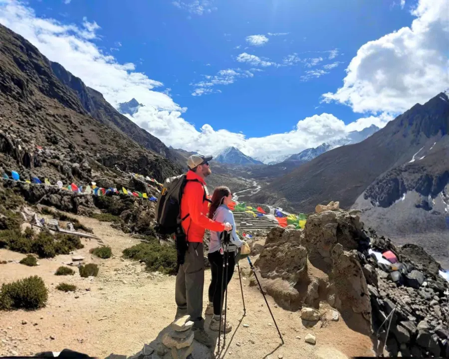
How close can you get to Mount Everest without climbing it?
Six places put you within sight of Everest without a rope, and they range from a one day flight to a three week walk. Choosing between them is really a choice about altitude tolerance, time and what you want to see, because the closest option and the best view are not the same place.
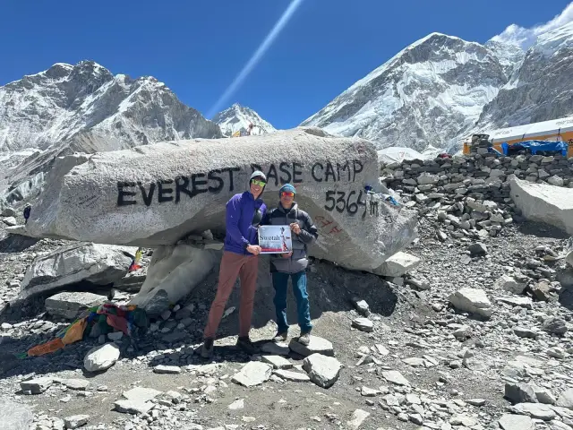
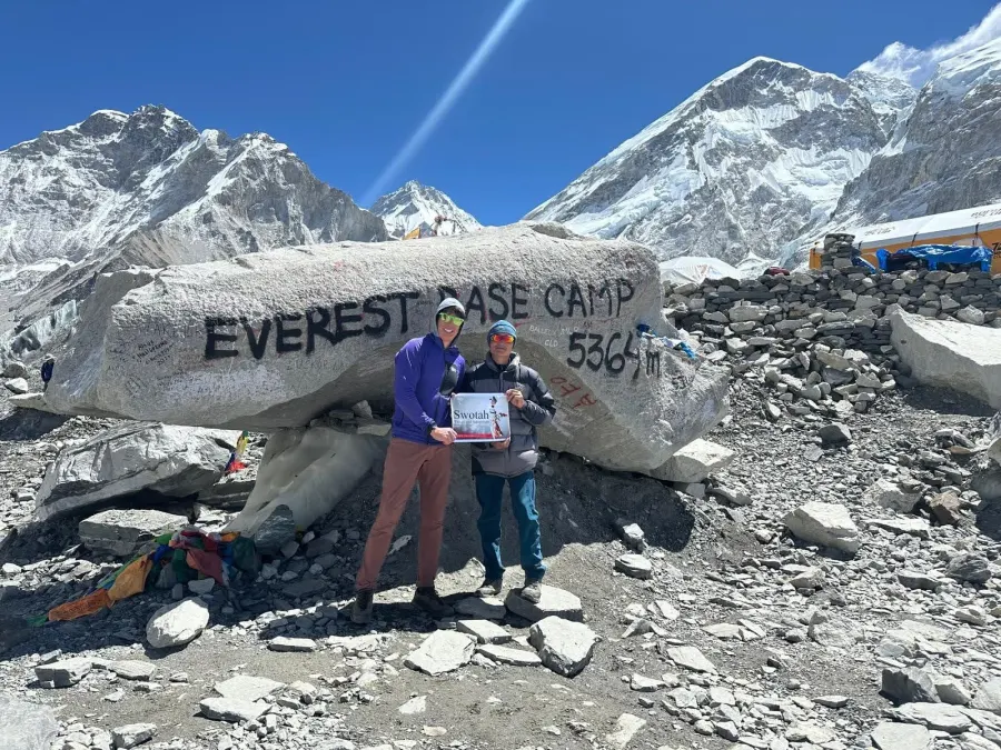
Everest Base Camp, Nepal, 5,364 m
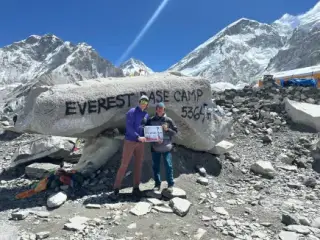
Everest Base Camp on the Khumbu Glacier is the closest a non-climber can legally and safely stand to the mountain, and it is where the spring expedition city of several hundred tents appears each April and May. It takes about eight days of walking from Lukla, with acclimatisation stops at Namche and Dingboche, and the standard round trip from Kathmandu runs around fourteen days.
Here is the fact most guides on this subject leave out. You cannot see the summit of Everest from Everest Base Camp. The west shoulder of Everest and the 7,861 m wall of Nuptse sit between you and the top, and they hide it completely. What you see from Base Camp is the Khumbu Icefall, the glacier, and a horseshoe of Nuptse, Pumori and Lingtren. It is a spectacular place to stand. It is just not the place to photograph the mountain.
Kala Patthar, Nepal, 5,545 m
Kala Patthar is a dark rock shoulder on the flank of Pumori, 180 m higher than Base Camp and about two hours' climb above Gorakshep. From this angle Nuptse drops out of the line of sight and the full south-west face of Everest stands clear from base to summit. It is the single best ground-level view of the mountain anywhere in Nepal, and it is the reason most itineraries schedule a pre-dawn start on the morning after Base Camp day. Our guide to Kala Patthar, the viewpoint of Everest covers the climb and the timing in detail.
North Base Camp, Tibet, about 5,150 m
North Base Camp in Tingri County is the only base camp on Everest you can reach by vehicle. A sealed road runs in from the Friendship Highway, so travellers who cannot walk for two weeks, or cannot acclimatise slowly, can stand below the north face in a day's drive from Shigatse. The view is better than the southern base camp view, since the north face is unobstructed from the Rongbuk valley. The trade-off is severe: you go from around 4,000 m to 5,150 m without the gradual gain that the Nepal route builds in, which raises altitude sickness risk sharply.
Gokyo Ri, Nepal, 5,357 m
Gokyo Ri rises above a chain of six turquoise glacial lakes in the valley west of the main Base Camp trail. From its top you see Everest, Lhotse, Makalu and Cho Oyu in one sweep, four of the world's six highest peaks, with the Ngozumpa Glacier below. Fewer trekkers come this way, so the lodges are quieter. Our complete guide to the Gokyo Ri trek compares it with the standard route.
Everest View Hotel and Tengboche, Nepal, 3,867 to 3,880 m
The Everest View Hotel above Namche sits at about 3,880 m and is reachable in three days of walking from Lukla, or by helicopter in under an hour from Kathmandu. Everest appears from its terrace as a dark triangle behind the Lhotse-Nuptse ridge, distant but unmistakable. Tengboche Monastery, an hour beyond, frames the same view with Ama Dablam alongside. For anyone who wants the Khumbu without crossing 4,000 m, this is the honest answer, and the Lower Everest Trek is built around exactly that ceiling.
Pikey Peak and the Kathmandu rim, 2,175 to 4,070 m
Pikey Peak, 4,070 m, sits in lower Solukhumbu and was reportedly Sir Edmund Hillary's favourite viewpoint of the mountain he climbed. It needs no flight to Lukla, since the trailhead is a drive from Kathmandu, and it delivers a panorama from Everest across to Kanchenjunga. Closer to the capital, Nagarkot at 2,175 m and Chandragiri on the valley rim show a very distant Everest on clear October to February mornings, before haze builds. It is a small white tooth on the horizon rather than a mountain filling the sky, but it is genuinely Everest.
From the air, no trekking at all
A one hour mountain flight from Kathmandu runs east along the range at cruising height and turns back within sight of the summit, and every passenger gets a window seat. Helicopter tours go further, landing at Kala Patthar or Gorakshep for a short stop and breakfast at the Everest View Hotel, which compresses the whole southern approach into a morning. Altitude gain that fast is not risk free, and operators keep the landings short for that reason.
| Viewpoint | Country | Altitude | How you get there | Days from Kathmandu | Summit visible? |
|---|---|---|---|---|---|
| Everest Base Camp | Nepal | 5,364 m | Fly to Lukla, then walk | 12 to 14 | No, Nuptse blocks it |
| Kala Patthar | Nepal | 5,545 m | Fly to Lukla, then walk | 12 to 14 | Yes, full south-west face |
| North Base Camp | Tibet, China | 5,150 m | Drive from Shigatse | 8 to 15 via Lhasa | Yes, full north face |
| Gokyo Ri | Nepal | 5,357 m | Fly to Lukla, then walk | 13 to 15 | Yes, with three other 8,000ers |
| Everest View Hotel | Nepal | 3,880 m | Walk or helicopter | 1 to 5 | Yes, distant |
| Pikey Peak | Nepal | 4,070 m | Drive, then walk | 5 to 12 | Yes, distant panorama |
| Nagarkot | Nepal | 2,175 m | Drive, 1.5 hours | Same day | Only on very clear mornings |
| Mountain flight | Nepal | Cruising height | Fixed-wing from Kathmandu | Same day | Yes, from the air |
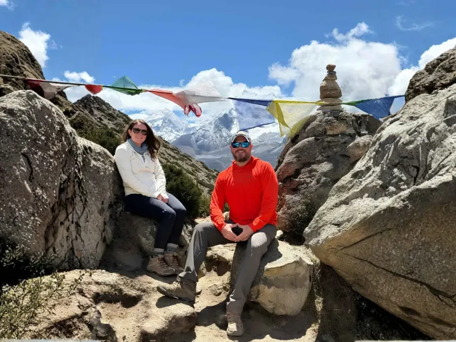
Should you visit the Nepal side or the Tibet side?
Most travellers who set out to see Everest choose Nepal, and the reasons are practical rather than patriotic. The southern approach gains altitude over eight days instead of one, which is the difference between acclimatising and gambling. It passes through inhabited Sherpa villages with lodges, bakeries, clinics and rescue helicopters on call. It needs a tourist visa you can buy on arrival at Kathmandu airport. And it ends at Kala Patthar, which gives a better view of the mountain than anywhere on the ground in Nepal.
The Tibet side earns its case on three counts. The north face is unobstructed, so the view from the Rongbuk valley is cleaner than anything at the southern base camp. You can drive there, which opens the mountain to travellers who cannot walk for two weeks. And the plateau scenery, Shigatse's Tashilhunpo Monastery, the Friendship Highway, Rongbuk, is a different experience from the Khumbu rather than a lesser one. Travellers often combine it with Mount Kailash and the northern Everest base camp in a single Tibet itinerary.
The altitude arithmetic is the deciding factor. Walking the Nepal route, you gain roughly 2,500 m over eight days with two rest days built in. Driving to North Base Camp, you can go from Lhasa at 3,650 m to 5,150 m in about three days. Acute mountain sickness rates rise steeply with fast ascent, so if anyone in your group has a history of altitude trouble, the Nepal side is the safer answer regardless of preference.
What permits do you need to reach Mount Everest?
Two permits cover the Nepal side, and neither of them is TIMS. The Sagarmatha National Park entry permit costs NPR 3,000 for foreign nationals, and the Khumbu Pasanglhamu Rural Municipality permit costs NPR 3,000, raised from NPR 2,000 in 2025. The municipality permit replaced the TIMS card in the Khumbu in 2018, and it is issued at Lukla or Monjo rather than in Kathmandu. SAARC nationals pay a reduced NPR 1,500 for park entry. Trekking agencies handle both as a matter of course.
Tibet is a different system entirely. You need a Chinese visa, then a Tibet Travel Permit issued through a registered Tibetan agency, and then an Alien's Travel Permit for Tingri County, because Everest sits in a restricted border zone. Independent travel is not permitted. You must be booked with a licensed operator on a fixed itinerary, with a guide and a driver, and permit processing needs two to three weeks of lead time. Border rules there change with little notice, so confirm current status before booking flights.
When is Mount Everest visible?
Two windows give reliable visibility. Late September to early December brings the clearest air of the year, after the monsoon has washed the dust out and before winter haze settles over the lowlands. March to May is the second window, warmer and busier, with more afternoon cloud but stable mornings. In both, the mountain is usually clear at dawn and increasingly veiled from late morning as valley cloud builds.
June through August is monsoon in Nepal, and Everest spends most of it inside cloud. Even at Base Camp you can pass a whole day without seeing the surrounding peaks. Our guide to the best time for the Everest Base Camp trek goes through each month in detail, including what winter trekking on the route actually involves.
Always start early. Whether you are on Kala Patthar, at Nagarkot or on a mountain flight, the reliable viewing hours are from first light to about 10 am. That single habit does more for your chances of seeing the mountain than choosing the perfect month.
Who can climb Mount Everest, and from where?
Two routes carry almost all summit traffic. The South Col route from Nepal is the line Edmund Hillary and Tenzing Norgay climbed on 29 May 1953, running through the Khumbu Icefall, the Western Cwm, the Lhotse Face and the South Col at 7,906 m. The North Col route from Tibet follows the East Rongbuk Glacier and the north-east ridge, the line the British attempted through the 1920s. Expeditions from the Nepal side need a royalty of USD 15,000 per climber in the spring season, alongside the expedition permit, a liaison officer and a mandatory guide.
A full expedition runs roughly two months, since acclimatisation rotations up the mountain take weeks before a summit window opens. Our Mount Everest Expedition covers the 64 day South Col programme. Most travellers reading about Everest's location are not headed there, and the honest framing is that Base Camp and Kala Patthar are a walking holiday at altitude, while the summit is a technical climb with a real fatality rate.
Frequently asked questions about Mount Everest's location
What country is Mount Everest in?
Mount Everest is in two countries. The border between Nepal and the Tibet Autonomous Region of China runs over the summit, so the southern half sits in Solukhumbu District, Nepal, and the northern half in Tingri County, China. The 1961 Nepal-China Boundary Treaty fixed that line.
What are the GPS coordinates of Mount Everest?
27.9881° N, 86.9250° E, which is 27°59'17" north and 86°55'31" east. Those coordinates mark the summit point on the Nepal-China border.
How far is Mount Everest from Kathmandu?
About 145 km east-northeast in a straight line. Travel time is measured in days rather than distance, because no road reaches the Nepal side. A flight to Lukla takes 35 minutes, and the walk from Lukla to Base Camp takes about eight days with acclimatisation.
Can you see Mount Everest from Everest Base Camp?
No. The west shoulder of Everest and the Nuptse wall block the summit from Base Camp at 5,364 m. The nearest ground viewpoint with a clear summit view is Kala Patthar at 5,545 m, about two hours above Gorakshep.
Can you drive to Mount Everest?
Only on the Tibet side. A sealed road reaches North Base Camp at roughly 5,150 m in Tingri County. On the Nepal side there is no road beyond Lukla, so every approach from the south is on foot or by helicopter.
Which mountain range is Mount Everest in?
The Mahalangur Himal, a sub-range within the eastern Himalaya. Lhotse, Makalu and Cho Oyu, three more of the world's fourteen 8,000 m peaks, sit in the same sub-range.
What is Mount Everest called in Nepal and Tibet?
Sagarmatha in Nepali, coined by the historian Baburam Acharya in the 1930s, and Chomolungma or Qomolangma in Tibetan, recorded on a Chinese map in 1721. The English name dates from 1865, after the surveyor Sir George Everest.
Do you need a permit to visit Everest Base Camp?
Yes, two on the Nepal side: the Sagarmatha National Park entry permit at NPR 3,000 and the Khumbu Pasanglhamu Rural Municipality permit at NPR 3,000. TIMS is not required in the Khumbu. The Tibet side needs a Chinese visa, a Tibet Travel Permit and an Alien's Travel Permit, all arranged through a licensed operator.
What is the closest town to Mount Everest?
Gorakshep at 5,164 m is the closest settlement with lodging on the Nepal side, a seasonal cluster of teahouses about three hours below Base Camp. The nearest permanent town of any size is Namche Bazaar at 3,440 m.
Planning your own trip to Everest
The geography decides most of your itinerary before you pick a date. If you want the closest legal standing point, that is Base Camp on the Nepal side, fourteen days from Kathmandu. If you want the photograph, that is Kala Patthar on the same trip, one morning later. If you cannot spare two weeks or cannot acclimatise slowly, the choice is a helicopter day tour on the Nepal side or the drivable North Base Camp in Tibet. If you want the mountain without crossing 4,000 m, the Lower Everest route to the Everest View Hotel and Tengboche does it in eleven days.
Swotah Travel runs Khumbu itineraries every season, and our team in Kathmandu builds each one around the acclimatisation profile rather than the calendar. Tell us how many days you have and what altitude you are comfortable with, and we will tell you honestly which of these viewpoints fits. Start with our Everest Base Camp trek map to see the route stage by stage, or talk to a Nepal specialist about your dates.