



What Actually Caused the Rasuwa Flood (It Wasn't a GLOF)
At 08:37 Nepal time on 26 August 2026, a block of bedrock and glacier ice roughly 600 metres wide broke off the north face of Langtang Lirung and fell about 1,200 vertical metres into the valley below. It was not a glacial lake outburst flood. Scientists at the International Centre for Integrated Mountain Development (ICIMOD) and Nepal's Department of Hydrology and Meteorology considered a GLOF early on and ruled it out, describing instead a four stage chain: a rock and ice avalanche, a temporary natural dam across the Lhende Khola, a sudden dam break, and a debris flow that ran down the Bhotekoshi into the Trishuli at speeds near 50 metres per second. The distinction matters more than it sounds. A GLOF and a rock and ice avalanche start in different places, give different amounts of warning, and are watched for by different methods. Getting the label wrong changes what anyone plans for next.
\n\nThe four stages scientists have reconstructed
\n\nReconstruction of the event came from seismic records, satellite imagery and field reports compiled in the days after 26 August. The collapse registered as a magnitude 5.2 surface wave seismic signal, which is how researchers pinned the timing to the minute. What follows is the sequence as ICIMOD and the Department of Hydrology and Meteorology have described it.
\n\nStage one: bedrock fails at 5,200 metres
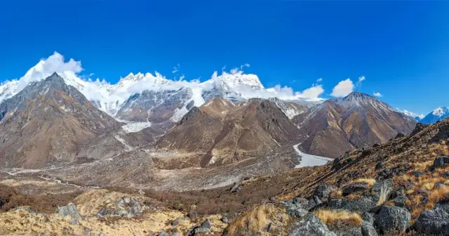
\n\nThe detachment began at roughly 5,200 metres on the north face of Langtang Lirung, inside Langtang National Park and around 64 kilometres north of Kathmandu. Estimates put the volume between 100 and 200 million cubic metres of rock and ice. Dr Mohd. Farooq Azam, a cryosphere specialist at ICIMOD, put the order of events plainly: "When the bedrock gave way, the glacier on top also got swept." The glacier was a passenger, not the trigger. Sunwi Maskey, a cryosphere researcher at the same institution, added the question that is still open: "Such a massive block does not generally just fall."
\n\nStage two: the debris dams the Lhende Khola
\n\nThe mass came to rest across the Lhende Khola, a small transboundary tributary that feeds the Bhotekoshi. Binod Parajuli of the Department of Hydrology and Meteorology described a path that crossed an international border twice: "The avalanche originated on Nepali territory, but after it came down it crossed the Nepal-China border." For a short window the river had nowhere to go, and water began stacking up behind a wall of rubble that nobody had built and nobody was watching.
\n\nStage three: the dam gives way
\n\nLandslide dams are unstable by construction, because loose debris has no engineered spillway and no compaction. Dr Upmanu Lall of the Columbia Water Center described the failure mode: "When all the water is released almost instantly, it can turn into a violent flash flood." That is what separated this event from ordinary monsoon flooding on the same river. The volume was not delivered over hours of rain. It arrived as one release.
\n\nStage four: the surge runs the corridor
\n\nThe debris flow travelled close to 100 kilometres downstream through the Bhotekoshi and into the Trishuli. It destroyed the Rasuwagadhi customs post and the Gyirong border complex, took out the road and bridges north of Betrawati, and swept through Timure and Syabrubesi. Bodies were later recovered in eight districts, as far south as Chitwan and Nawalparasi. The warning available to anyone standing in the corridor was measured in minutes.
\n\nWhy "GLOF" stuck, and why it is wrong here
\n\nThe GLOF label spread because it was correct thirteen months earlier on the same river. On 8 July 2025, the Bhotekoshi flooded after a supraglacial lake burst in Tibet. That lake sat at 5,150 metres, about 36 kilometres upstream of Rasuwagadhi, covered 0.75 square kilometres, and had grown quickly on satellite imagery between December 2024 and June 2025. The Department of Hydrology and Meteorology and ICIMOD identified it as the source. That flood killed at least nine people and destroyed the Miteri bridge linking Nepal and China.
\n\n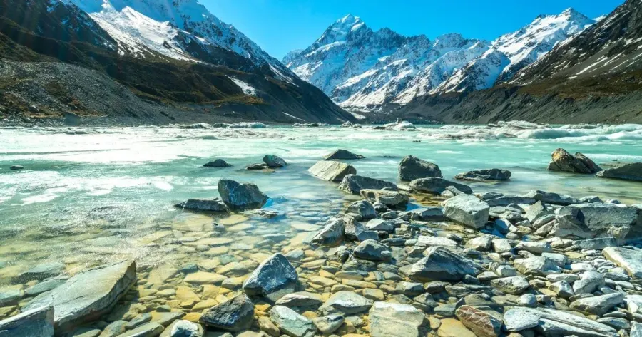 \n
\n Two floods, one river, a little over a year apart, and two genuinely different causes. Anyone reaching for the 2025 explanation in August 2026 would have landed on the wrong one. The practical consequence is that a monitoring programme built only around expanding glacial lakes would not have flagged Langtang Lirung, because the hazard there was a rock face, not a lake. Our earlier piece on which treks are affected by the Nepal flood 2026 covers the operational side of the same event.
\n\nRock and ice avalanche, GLOF, landslide dam: three different mechanisms
\n\nA glacial lake outburst flood is the sudden drainage of a lake held back by ice or moraine, usually after the dam is overtopped or the ice core melts through. The water exists before the event, so satellite monitoring of lake area gives some lead time.
\n\nA rock and ice avalanche is the detachment of bedrock with glacier ice sitting on top of it, falling under gravity. No lake is involved at the start. Seismic networks can detect it, but only as it happens.
\n\nA landslide dam break is the secondary event, when debris from a slope failure blocks a river and the impoundment later fails. The Rasuwa flood was a rock and ice avalanche that produced a landslide dam, which then broke. Three mechanisms, one morning.
\n\nWhat the numbers are, and how firm they are
\n\nCasualty figures from this flood are still moving, and different authorities are counting differently. Nepal Police's count for the evening of 6 September 2026, released in the early hours of 7 September, put the toll at 1,353 bodies recovered and 3,992 people unaccounted for, up from 626 dead and 2,426 missing in the first days of the disaster. Including Tibet, where flooding in Gyirong county killed dozens more, the two-country total runs higher still. Damage estimates exceed 200 billion rupees, with 41 bridges and 42 kilometres of road destroyed and 431 megawatts of generation taken off the national grid; a separate collapse of the Prithvi Highway at Krishnabhir on 30 August cut a second, unrelated route south of the flood zone and remains only partly bypassed. Treat every one of these as a snapshot with a date attached rather than a settled number. Our Rasuwa flood situation page carries a dated log and is updated by hand as the figures firm up.
\n\nWhere this leaves the wider hazard picture
\n\nICIMOD and UNDP have identified 47 potentially dangerous glacial lakes across the Koshi, Gandaki and Karnali basins, 21 of them inside Nepal, out of more than 25,000 glacial lakes across the wider region. Nepal has recorded over 90 glacial lake outburst floods since the early 1920s. That inventory is real and it is worth funding. It also would not have caught this one. Slope stability at 5,000 metres is a separate monitoring problem from lake growth, and the upper catchment of the Bhotekoshi sits inside Tibet, which makes routine observation a matter of cross-border data sharing rather than fieldwork.
\n\nDoes this change anything for trekking in Nepal?
\n\nGeographically the answer is narrower than the headlines suggest. This was one river corridor in one district. The Everest, Annapurna and Manaslu regions sit in entirely different catchments hundreds of kilometres away and saw no flood damage. Rasuwa itself is a different matter. Syabrubesi, the Tamang Heritage Trail and road access to the Langtang Valley trek and Gosainkunda should be treated as closed until surveyors have been through. Our travel update page lists the current status of every trek and tour we run, route by route, and is the page to check before you book.
\n\nThe honest summary of the science is that a mountain failed without a lake being involved, and the people downstream had minutes. That is a different problem from the one Nepal has spent two decades preparing for, and it is the one the next monitoring programme has to solve. This article was last updated on 8 September 2026; the causal reconstruction here has not changed since publication, only the casualty and recovery figures.
\n