


Renjo La is a 5,360 m pass on the west side of the Everest region, linking the Gokyo lakes with the Bhote Koshi valley above Thame. It's the lowest of the three passes on the Everest Three Passes trek. Most people cross from Gokyo: about 570 m of climbing to the top, then a steep drop to Lungden (4,380 m), 7 to 8 hours in all. From the top you see Everest, Lhotse, Makalu and Cho Oyu above the turquoise Gokyo lake. Cross in spring or autumn. Spend two nights at Gokyo first and leave before dawn, because cloud and wind usually build by late morning. You need the Khumbu municipality permit and the Sagarmatha National Park permit, and in 2026 the guide rule isn't enforced in the Khumbu.
- Altitude5,360 m / 17,585 ft
- ConnectsGokyo (4,790 m) and Lungden (4,380 m)
- Crossing day7 to 8 hours, Gokyo to Lungden
- Climb from GokyoAbout 570 m
- Best monthsMarch to May, October to November
- PermitsKhumbu card + Sagarmatha National Park
Have you ever thought about what it is like to embark on a journey few have dared to take? To trek the high Himalayan ridges, glide amidst Khumbu's snow-topped summits, and cross the Renjo La Pass, above the old yak-caravan route to Tibet over the Nangpa La?
Every step the bold trekker undertakes in this unfamiliar terrain is a pioneering escapade, an exploration of boundless revelation and loveliness. The spellbinding vistas of endless peaks that stretch beyond sight welcome you into this enchanting terrain, along with enigmatic monasteries set on age-old hills.
But what lies ahead when the explorer ascends the renowned Renjo La Pass? Would it be the summit of Everest, seen from a side that trekkers bound only for Everest Base Camp never get? Or the mysterious turquoise lakes hidden among the rocky ridges near Gokyo Ri? The answers to these questions can only be found through this blog below.
Overview
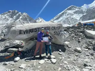
The Renjo La Pass is a high pass in the Everest region of the Himalayas, at 5,360 meters / 17,585 feet. It is the lowest of the three passes on the Everest Three Passes trek, and about the same height as Everest Base Camp. It connects the Gokyo Valley with the Bhote Koshi valley above Thame, whose villages once traded over the Nangpa La into Tibet, and navigating it can be intimidating.

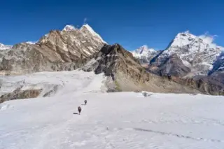
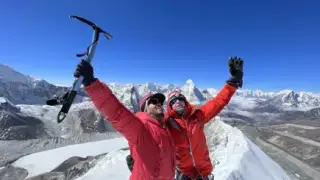
Photo: View from Renjo-La Pass
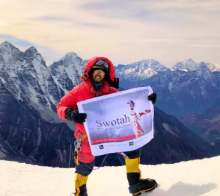
Renjo La, the high pass in the Everest region, provides wide panoramas of the mighty Mount Everest and the neighboring glistening peaks. It is a pass that has gained fame for its views and draws in adventure seekers, including trekkers and mountaineers, eager to loll in the region's unparalleled splendor. The climb itself can be pretty challenging, depending on the route taken. The usual route climbs the Gokyo side of Renjo La and slowly winds through the boulders and scree, with views back over the Gokyo lakes and the Ngozumpa Glacier. As you make your way through the pass, take plenty of breaks to enjoy the scenery.
The crossing itself takes one long day, but you reach it as part of a longer trek: about two weeks for a Gokyo and Renjo La loop, or 21 days on the full Three Passes trek. Coming from Gokyo, you finish the day in Lungden and walk on to Thame. This is where the excitement takes off, as the quaint Tibetan and Sherpa traditions in these charming towns offer a truly unforgettable experience. Things like centuries-old gompas, traditional Sherpa dishes, and grazing yak herds can be found in these villages, making the Renjo La Pass one of the region's most exciting and rewarding treks. Viewing great peaks like Mt. Lhotse (8,516 m), Mt. Nuptse (7,861 m), Mt. Pumori (7,161 m), Mt. Ama Dablam (6,812 m), Mt. Thamserku (6,623 m), Mt. Kongde (6,187 m), Cho Oyu (8,188 meters/ 26,864 ft) and, far to the east, Makalu (8,485 m), all from one viewpoint, makes the pass truly special. On a clear day, you can even see Mount Everest (8,848.86 meters / 29,032 ft). As you stand at the top of Renjo La Pass and observe these majestic mountains, it feels as if you could reach out and touch them.
As you journey closer, the Nepalese culture will be all around you. Trekkers are often warmly welcomed by the locals. Traditional accommodations such as tea lodges and homestays will be on offer as you travel further and further away from the bustling cities of Nepal.
You will observe and perhaps learn about Sherpa culture, passed down through generations of Buddhist Sherpa families. Prayers can be heard as you pass stupas, monasteries, and gompas painted in the traditional colors of red, white, blue, and yellow.
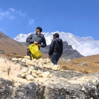
Marriages are celebrated traditionally in the region with chanting, singing, and even dancing. The songs and circle dances of a Sherpa wedding often echo across the valley. Families still play a big part in arranging marriages, and wedding clothes and jewellery are often elaborate and expensive. Another Nepalese custom and tradition one can observe while trekking is the Mani walls. Mani walls line the trails in the Buddhist areas of Nepal and are formed with carefully piled stone slates with prayers of "Om Mani Padme Hum" engraved in each slate. Founded as an artistic and spiritual gesture, these walls are believed to bring spiritual protection and peace.
The Renjo La Pass trek, with its culture, traditions, views, foods, and people, is an absolute must to observe for any trekking enthusiast looking to dive deeply into Nepalese culture and customs. With each step, the mesmerizing allure of its ecological and historical riches pulls you in.
The Renjo La Crossing at a Glance
Most trekkers cross from east to west, starting at Gokyo. The climb is the shorter half of the day. The descent to Lungden is steeper than it looks from the top, on loose stone that's often icy before midday.
| Point | Altitude | Time |
|---|---|---|
| Gokyo | 4,790 m | Start before dawn |
| Renjo La | 5,360 m | 3 to 4 hours up from Gokyo |
| Lungden | 4,380 m | 3 to 4 hours down from the pass |
| Thame | 3,800 m | 4 to 5 hours, next day |
Bars start at 3,500 m so the differences show. Times are typical for a fit, acclimatised walker and stretch in snow.
Renjo La vs the Other Two Passes
On our 21-day Three Passes trek, Renjo La comes last and has the easiest climb of the three, measured from the lodge where you sleep the night before.
| Pass | Height | Start of the day | Climb to the top |
|---|---|---|---|
| Kongma La | 5,535 m | Chukung, 4,730 m | 805 m |
| Cho La | 5,420 m | Dzongla, 4,830 m | 590 m |
| Renjo La | 5,360 m | Gokyo, 4,790 m | 570 m |
Cho La has the short glacier crossing. Renjo La has no glacier, but its west side holds snow late into spring. See our Cho La Pass guide for the middle pass.
When to Cross Renjo La
| Months | Conditions | What to expect |
|---|---|---|
| March to May | Best | Clear mornings, longer days. Snow is still possible on the pass in March. |
| June to September | Possible | Monsoon cloud hides the view most days and the trail is wet, though the pass is usually open. |
| October to November | Best | The clearest, most settled weather of the year. |
| December to February | Risky | Fresh snow can close the pass for days, and lodges in Lungden and Gokyo may shut. |
Whichever month you pick, check the snow report in Gokyo the evening before. Lodge owners and guides coming the other way know whether the trail is broken.
Which direction should you cross?
Gokyo to Lungden is the better choice for most people. You sleep at Gokyo (4,790 m) before the pass, after a rest day there, so the 570 m climb comes when you're well acclimatised. Going the other way means climbing almost 1,000 m from Lungden on the day, without a high night beforehand, and it's a lot harder on the lungs.
Weather and Terrain Considerations
The rugged route from start to finish of the pass showcases a drastic shift in terrain, transitioning from a strenuous uphill climb to a perilous high-altitude descent. Navigating the pass demands varying degrees of physical aptitude and endurance. Trekkers must stay hydrated throughout their journey as the air is much drier at high altitudes. At 5,360 m each breath holds only about half the oxygen it would at sea level, so every step costs more effort.

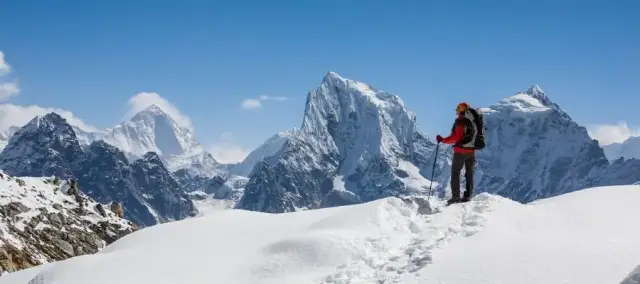
Photo: Renjo La Pass during Spring
Acclimatizing is essential, as it helps the physique adapt to low-oxygen surroundings. To conquer Renjo La Pass's crest at 5,360 m, a two to three-night acclimatization routine, stopping at various elevated villages along the way, is suggested. Most of a trekker's time during Renjo La Pass will be spent hiking uphill, but some parts of the pass also involve climbing large rocks, technically known as 'scrambling.' Expert mountaineers will secure their steps, but newbies are urged to seek a trekking guide's aid as the path can be tricky, and the danger of slipping threatens. Take note of the steep decline, too, as the narrow, slippery steps require caution.
The weather in the Everest Region is highly unpredictable. Generally, evenings in the lower elevations are cooler, and the nights get colder and frostier as the trekkers climb higher. During the day, the sun will provide warmth, but temperatures can drop drastically at dusk. As trekkers approach snow-capped peaks and higher altitudes, the temperatures become colder, accompanied by strong winds and a dramatic increase in precipitation. Even Summer trekkers should brace themselves for an adventure amidst rain, snow, and gusting winds.
The Cultural Significance of the Renjo La Pass Region
Nepal's Renjo La Pass in the Everest region holds cultural significance dating back centuries. Despite the challenging terrain, it draws a diverse crowd, from local herders and traders to hiking enthusiasts, both local and foreign, in pursuit of cultural heritage. A region of immense natural beauty, the Renjo La Pass is home to a diverse and tightly-knit community that expresses its traditional values through festivals, local food and the way its homes are built.
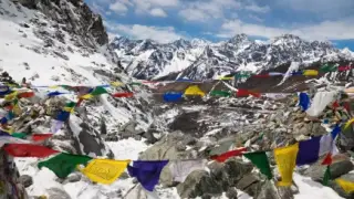
The Renjo La Pass region has played a huge role in shaping the cultural and spiritual beliefs of those who live in the region and those from other parts of the Himalayan area. Even today, Sherpas hang prayer flags and leave khata scarves on the cairns at the top of the pass, asking the mountain gods for safe passage through a hazardous high-altitude area.
The region has a rich culture and a thriving trekking economy, providing the locals with plentiful job opportunities. Adventure seekers mainly travel to this region for the thrill of trekking and scaling mountain peaks, while others come to explore the high-altitude terrain and engage in local pastimes. Climbing Mount Everest, a few valleys to the east, is still the region's biggest draw.
Festivals such as Mani Rimdu, held at Tengboche Monastery each autumn and at Thame Monastery, on the Renjo La route, each spring, bring out masked dancers in bright attire, a reflection of the area's customs and traditions. The Sherpa people, in particular, have a fascinating cultural tradition of traditional stone dwellings. Their stone houses sit low against the slope, with whitewashed walls, flat roofs weighted against the wind, and prayer flags streaming from every ridge line.
Khumbu society is organised quite differently from the caste-based hill districts further south: the Buddhist Sherpas reckon descent through clans known as ru, and village life is strikingly egalitarian, governed by rotating community duties and monastery committees rather than caste hierarchy.
Recommended Routes and Day Trips in the Area
For those looking to entice their adventurous souls and experience something unique, these are some recommended routes and day trips in Renjo La Pass Area:
The Renjo La Pass Trek's first route leads travelers through tranquil terrains, deep valleys, and regal mountain streams. It offers spectacular views of Gokyo Ri, Everest and the Ngozumpa Glacier. The typical trek day includes walking through yak pastures and rolling moraine before traversing a challenging pass. This is the Gokyo and Renjo La loop: up the Dudh Koshi to Gokyo, over Renjo La to Lungden, then down through Thame to Namche. It takes about 11 to 13 days on the trail from Lukla, crosses one high pass and sleeps in teahouse villages every night.
The second route is a trip to Gokyo Valley and Cho- La Pass. Gokyo Valley and Cho-La Pass offer a memorable journey that you can join to Renjo La Pass. Ideal for those seeking to discover the one-of-a-kind surrounding of Gokyo and Cho-La, the itinerary encompasses stops at Gokyo's picturesque lakes and a strenuous ascent to Cho-La Pass, towering at 5,420 meters (17,782 ft). The views of the Ngozumpa Glacier and the serene beauty of lakes surrounded by snow-capped peaks make this a highly recommended route. Lukla marks the journey's starting point, leading to Dingboche, Lobuche, and the ultimate destination of Everest Base Camp. The trek continues uphill alongside the Khumbu Glacier and over the Cho La Pass before descending to the picturesque Gokyo Lake and returning to Lukla. With views like these, this challenging trek suits any adventurous traveler.
Short hikes in the area are a great option if visitors are looking for something more gentle. From Thame, the walk up the Bhote Koshi valley to Lungden (4,380 m) is a long but steady day. The trail climbs gradually, passing through traditional yak-herding settlements, and offers views of numerous glaciers and towering mountain peaks.
Another day trip in the Renjo La Pass area, one of the best, is the hike to Ngozumpa Glacier. At about 36 km it is the longest glacier in Nepal, and it offers panoramic views of Cho Oyu, Kangtega, Thamserku, Ama Dablam, and other spectacular peaks. The hike is relatively easy, taking you up the moraine of the glacier and to a great viewpoint, from where you can take in the area's immense beauty.
Renjo La Pass is the perfect exploration of nature for any traveler looking for an adventure. With views of crystal blue waters, a pristine valley, and towering peaks, this trek offers a unique opportunity to observe the serenity of nature up close. Its excellent trails encourage adventure-seekers to bask in the rugged landscape while marveling at the snow-covered mountain ridges in the distance.
Renjo La Pass: FAQs
How high is Renjo La Pass?
5,360 m, or 17,585 ft. That makes it the lowest of the three Everest passes, below Cho La (5,420 m) and Kongma La (5,535 m), and almost the same height as Everest Base Camp (5,364 m).
How hard is the Renjo La crossing?
It's a hard day rather than a technical one. You walk 7 to 8 hours above 4,400 m, with loose rock and stone steps near the top and a steep, often icy descent. No climbing gear is needed in normal conditions, but microspikes help when there's snow.
Can you see Everest from Renjo La?
Yes. On a clear morning Everest, Lhotse, Makalu and Cho Oyu all show from the top, with Gokyo lake and the Ngozumpa Glacier below. Many trekkers rate it the best Everest view of the three passes.
Do I need a guide for Renjo La?
Nepal's licensed-guide rule isn't enforced in the Khumbu in 2026, so you can cross alone. A guide is worth it after fresh snow, when the trail on the west side disappears. If you go without one, cross with other trekkers and start early.
What permits do I need?
The Khumbu Pasang Lhamu municipality card (NPR 3,000) and the Sagarmatha National Park permit (NPR 3,000, bought at Monjo). There's no separate permit for the pass.